
See the places.
Inspect the data.
Explore real scenes from Terrain360's archive. Open the imagery, inspect the metadata and choose the collection your project needs.
Small premium packs · Named trails and waterways · Custom selections
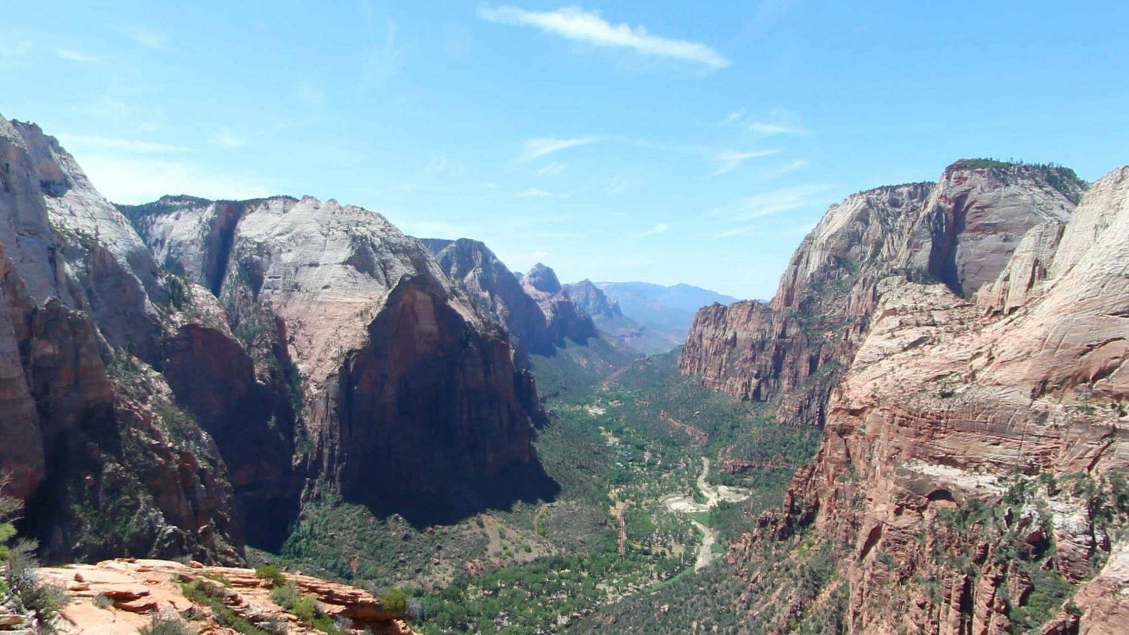
Angels Landing
Ridge and canyon views
5 August 2013
 Open full-size image ↗
High canyon panorama
5 Aug 2013 · Scene 5817
Layered rock and distant canyon scenery.
Ridge and canyon views
Eight views of exposed ridge steps, sandstone passages, pine-lined trail and Zion Canyon. A compact selection for evaluating the detail and structure of a licensed outdoor imagery package.
- Location
- Zion National Park, Utah
- Sample
- 8 images + scene metadata
- Images
- Rectilinear JPEG · 75° view
- Metadata
- CSV · JSONL · GeoJSON
5.7 MB ZIP · Evaluation sample with terms and checksums
What you receive & scope
The prepared native collection contains 8 reconstructed panoramas, 48 assembled cube faces, scene metadata, a searchable SQLite index and a signed manifest. Native ZIP: 678.5 MB. Permitted use is specified in the order.
Selected views from one 2013 capture sequence. Historical imagery; complete-hike coverage and current trail conditions are not asserted. Polar gaps and source stitching limitations remain in the panoramas.
Inspect sample metadata (JSONL) · Recorded locations (GeoJSON)
Example applicationsScenic imagery evaluation, visual research, trail features and selected AI or GIS workflows.
James River Boat Landings
Six places to inspect the water's edge
August 2012 · September 2020
 Open full-size image ↗
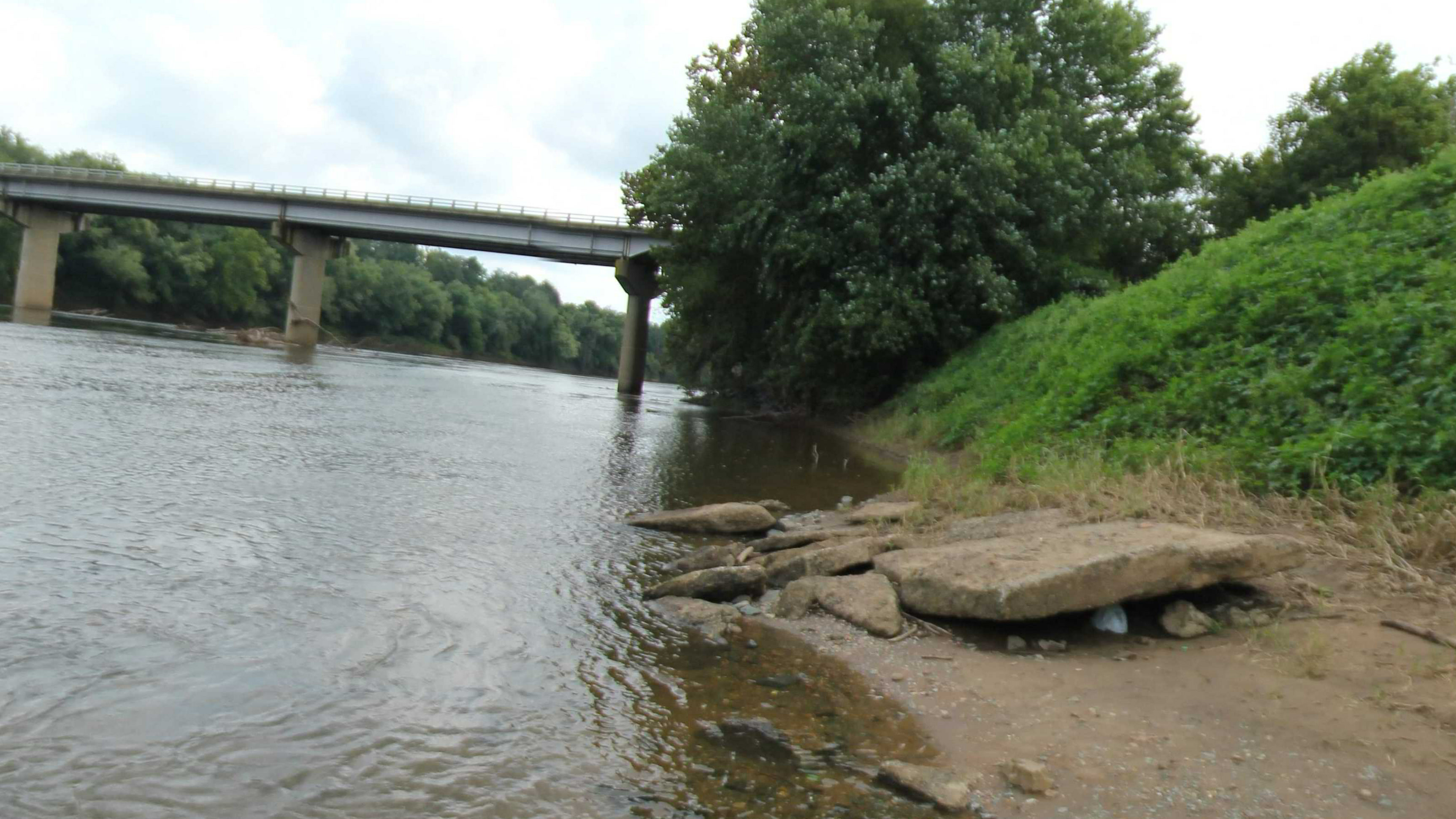
Columbia Landing
18 Sep 2020 · Scene 727597
Landing edge, exposed bank and bridge context.
Six places to inspect the water's edge
Inspect river edges, landing approaches, banks and nearby infrastructure at six named James River sites. Each view is tied to its source scene, recorded position and capture date.
- Location
- James River, Virginia
- Sample
- 6 images + scene metadata
- Images
- Rectilinear JPEG · 75° view
- Metadata
- CSV · JSONL · GeoJSON
6.3 MB ZIP · Evaluation sample with terms and checksums
What you receive & scope
The demo download contains 6 selected rectilinear JPEGs, JSONL and CSV metadata, recorded-location GeoJSON, evaluation terms and a signed manifest. Broader site or corridor delivery is selected and qualified to your order.
Six sample scenes across six source sites. The sample is not an inventory of every public-access site or a statement of current access, permissions, safety or conditions.
Inspect sample metadata (JSONL) · Recorded locations (GeoJSON)
Example applicationsRiver-access planning, historical site context, visual GIS analysis and scoped RAPG observations.
Appalachian Trail
Forest paths, rock views and built crossings
April–June 2013
 Open full-size image ↗
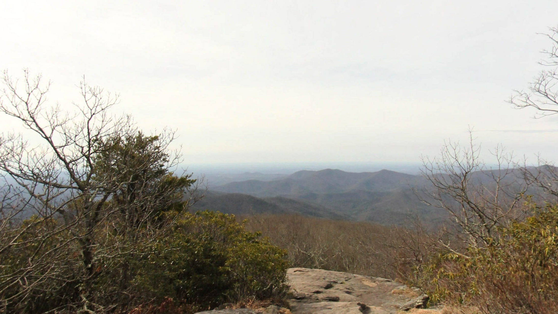
Blood Mountain / Neels Gap
3 Apr 2013 · Scene 6703
Rock foreground and distant mountain ridges.
Forest paths, rock views and built crossings
Six scenes across six named source trail sections show forest paths, rocky viewpoints and built crossings. Explore the scene detail, then define the route segment or terrain your project needs.
- Location
- Selected Appalachian Trail sections
- Sample
- 6 images + scene metadata
- Images
- Rectilinear JPEG · 75° view
- Metadata
- CSV · JSONL · GeoJSON
10.2 MB ZIP · Evaluation sample with terms and checksums
What you receive & scope
The demo download contains 6 selected rectilinear JPEGs, JSONL and CSV metadata, recorded-location GeoJSON, evaluation terms and a signed manifest. Native panoramas, cube faces, route coverage and annotations are separately scoped for delivery.
Historical views from six source sections, not continuous or complete Appalachian Trail coverage. Recorded coordinates are unverified; visible features are qualitative observations rather than measurements or accepted task labels.
Inspect sample metadata (JSONL) · Recorded locations (GeoJSON)
Example applicationsTrail and park planning context, surface and obstacle research, visual navigation and custom feature labels.
A particular river, trail
or a few exceptional scenes?
Choose a named place, region, terrain or capture period. We can add image labels and scoped RAPG or MS4 observations to fit your workflow.
Tell us what you need ↗- Choose the imageryShare the locations, subjects and level of detail you need.
- Agree the collection and licenseExact scenes and formats, AI, GIS/environmental or media use, and any annotations.
- Receive your packageSelected imagery, structured metadata and a file manifest with checksums.
These samples support evaluation of the imagery and metadata. Captures are historical. Recorded positions and times retain source uncertainty, and sample coverage is explicitly limited to the listed scenes. Commercial use requires an order specifying the delivered set and permitted uses. Read the evaluation and licensing terms.