First Landing State Park Terrain360 Map Collection

The First Planned State Park of Virginia

First Landing State Park (formerly Seashore State Park) offers recreational opportunities at Cape Henry in the independent city of Virginia Beach, Virginia. The entire park is listed on the National Register of Historic Places as Seashore State Park Historic District, for its significance as the first planned state park of Virginia. The state park is near the site of the first landing on April 26, 1607 of Christopher Newport and the Virginia Company colonists before establishing themselves at Jamestown. 

First Landing offers boating, swimming, nature and history programs, hiking, biking, picnicking, a boat launch, cabins and 19 miles (31 km) of trails on 2,888 acres (11.69 km2). It also has campsites that have water and electric hook-ups. The park's name was changed in 1997 from Seashore State Park to First Landing State Park to reflect its heritage as the first place where members of the Virginia Company landed (though its former name is still commonly used by Tidewater locals). 
Virginia's most popular state park, it's visited by over a million people each year. Its main entrance is located on Shore Dr. across from the beach camping entrance.

Source: Wikipedia.org; Photo: 
By Virginia State Parks staff [CC BY 2.0 (http://creativecommons.org/licenses/by/2.0)], via Wikimedia Commons

Bald Cypress Trail (0.22 mi)

36.914845, -76.039726
Bald Cypress Trail  scene image looking forward

Boardwalk (0.16 mi)

36.923847, -76.045967
Boardwalk  scene image looking forward

FLSP Campsite (0.01 mi)

36.91906, -76.050575
FLSP Campsite  scene image looking forward

Fox Run Trail (0.33 mi)

36.914505, -76.044533
Fox Run Trail  scene image looking forward

King Fisher Trail (0.55 mi)

36.907856, -76.030357
King Fisher Trail  scene image looking forward

Live Oak Trail (0.24 mi)

36.918163, -76.052895
Live Oak Trail  scene image looking forward

Long Creek Trail (3.78 mi)

36.889061, -76.001549
Long Creek Trail  scene image looking forward

Osmanthus Trail (2.4 mi)

36.915157, -76.035378
Osmanthus Trail scene image looking forward

Explore the Map

Click on any line in the map to explore the location in street view.

Follow the Long Creek Trail

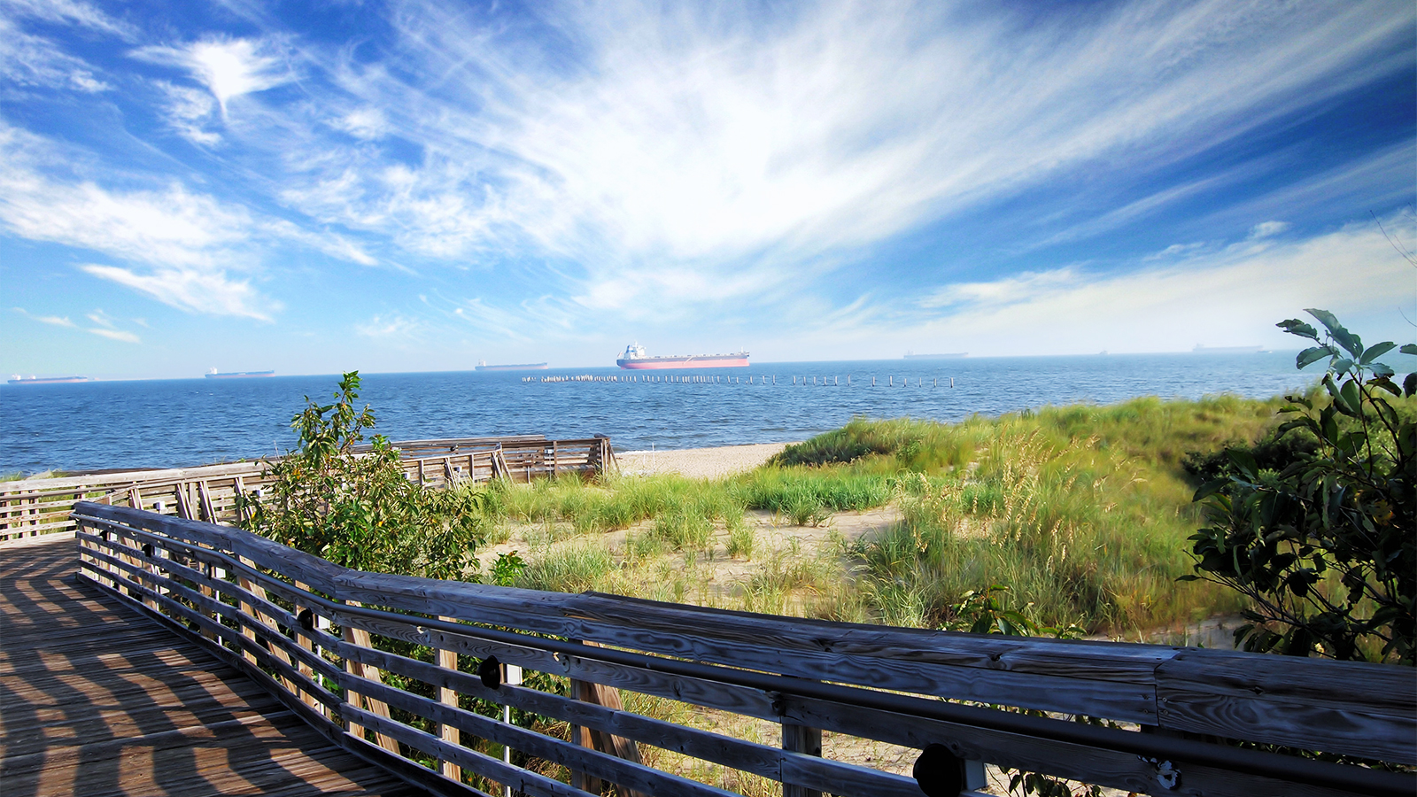
The trail roughly parallels the Cape Henry Trail but offers a much different hiking experience. It follows along the edge of the bay and salt marsh lands for over half its 5 mile length. It also passes near While Hill Lake, offering lovely views of the lake and the open wetlands that surround it. Just south of its northern junction with Long Creek Trail, there is a salt marsh boardwalk and a viewing platform. This trail is one of the best bird watching trails in the park, especially along its southern half.