DB00101
Erosion & Sediment Control Assessment
Comprehensive erosion hazard assessment, soil stability, drainage analysis, and remediation recommendations
Viewing 16 of 16 analyzed scenes | Page 1 of 1
Collections:
CHALET RR BR, NEORSD RSS 2023-2025
Scene #0
Erosion & Sediment Control Assessment
EXCELLENT
Front
E 92°
Right
S 182°
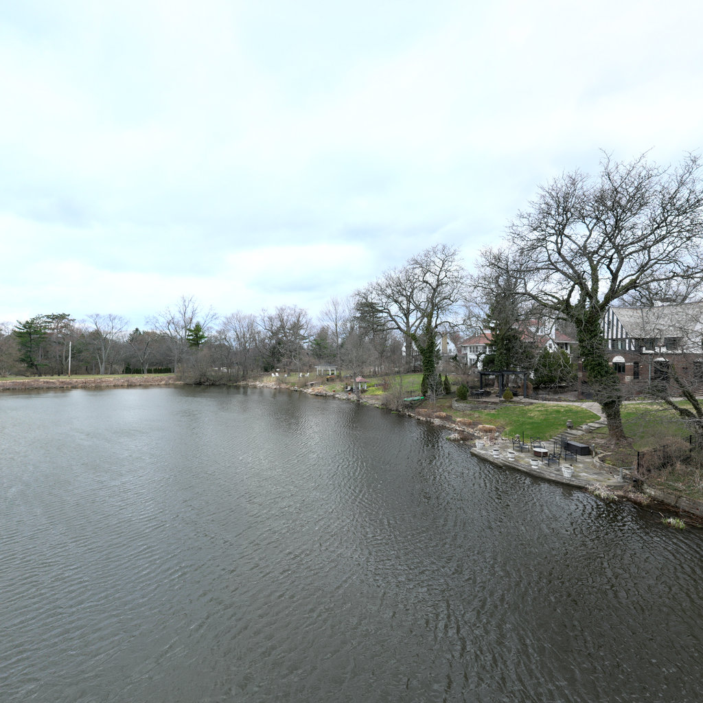
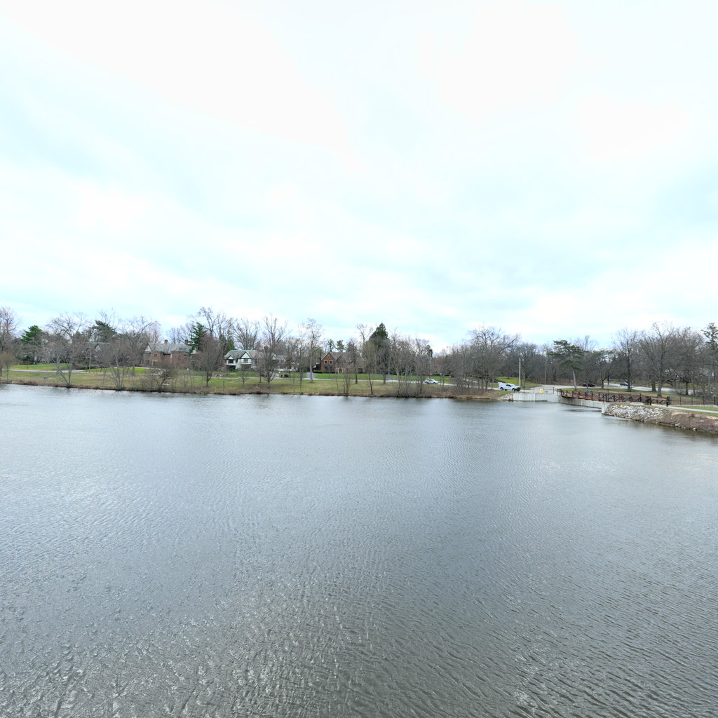
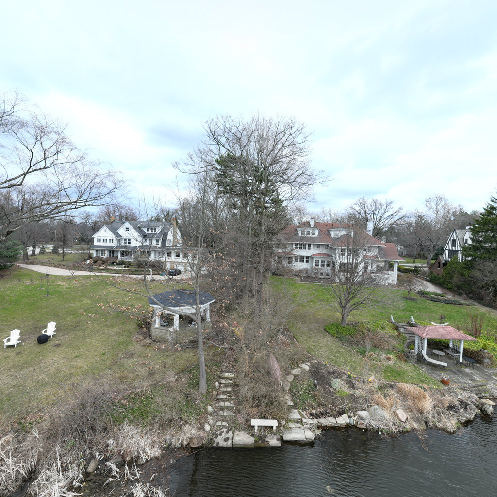
Back
W 272°
Left
N 2°

Up
Down
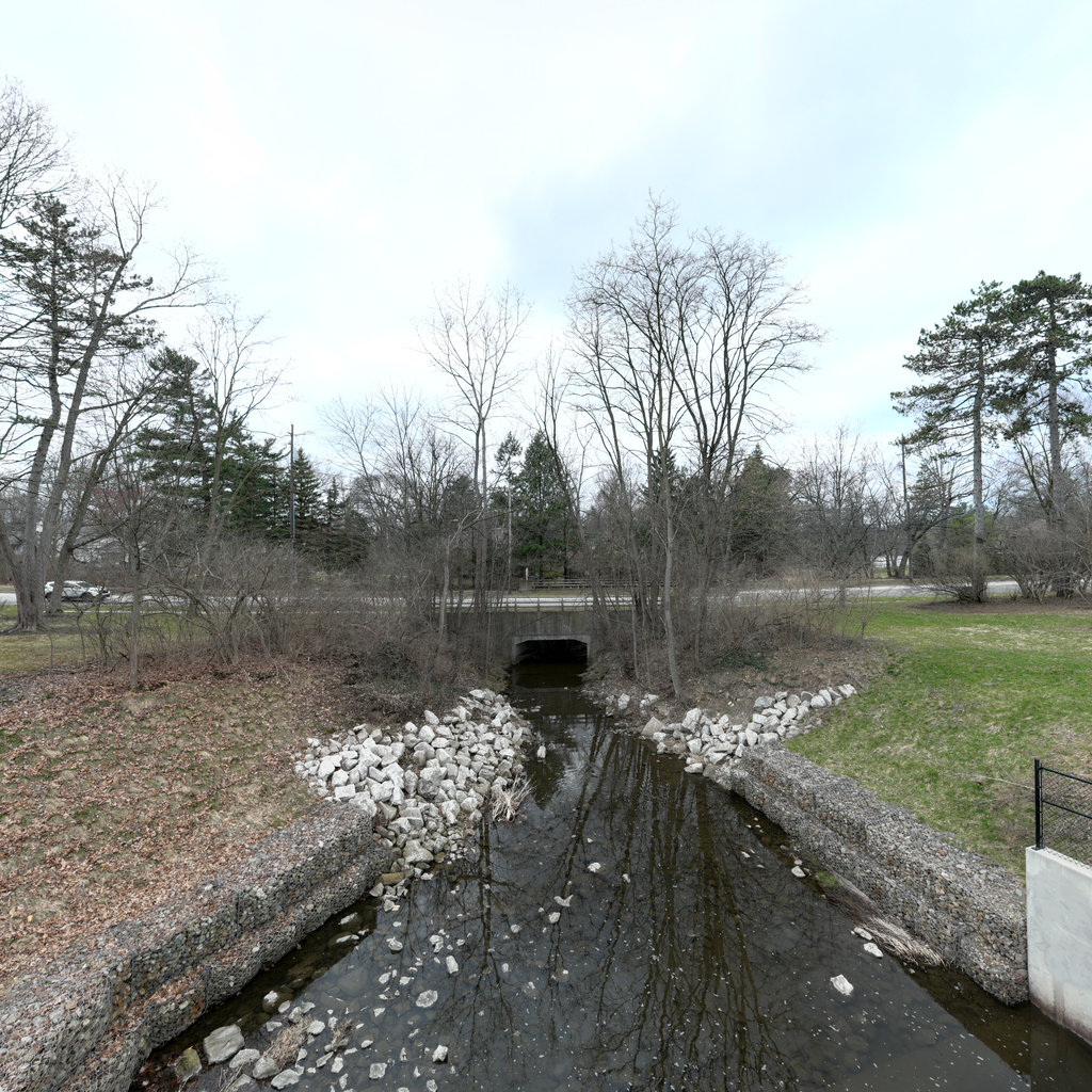
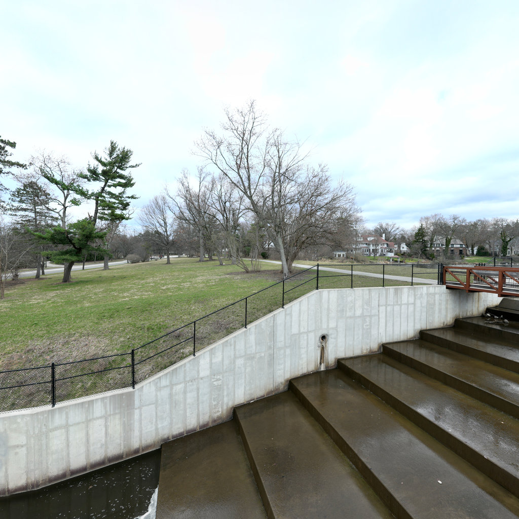
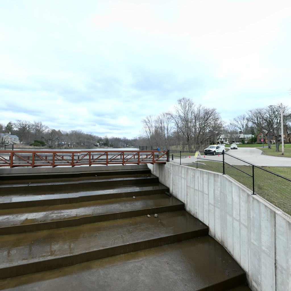
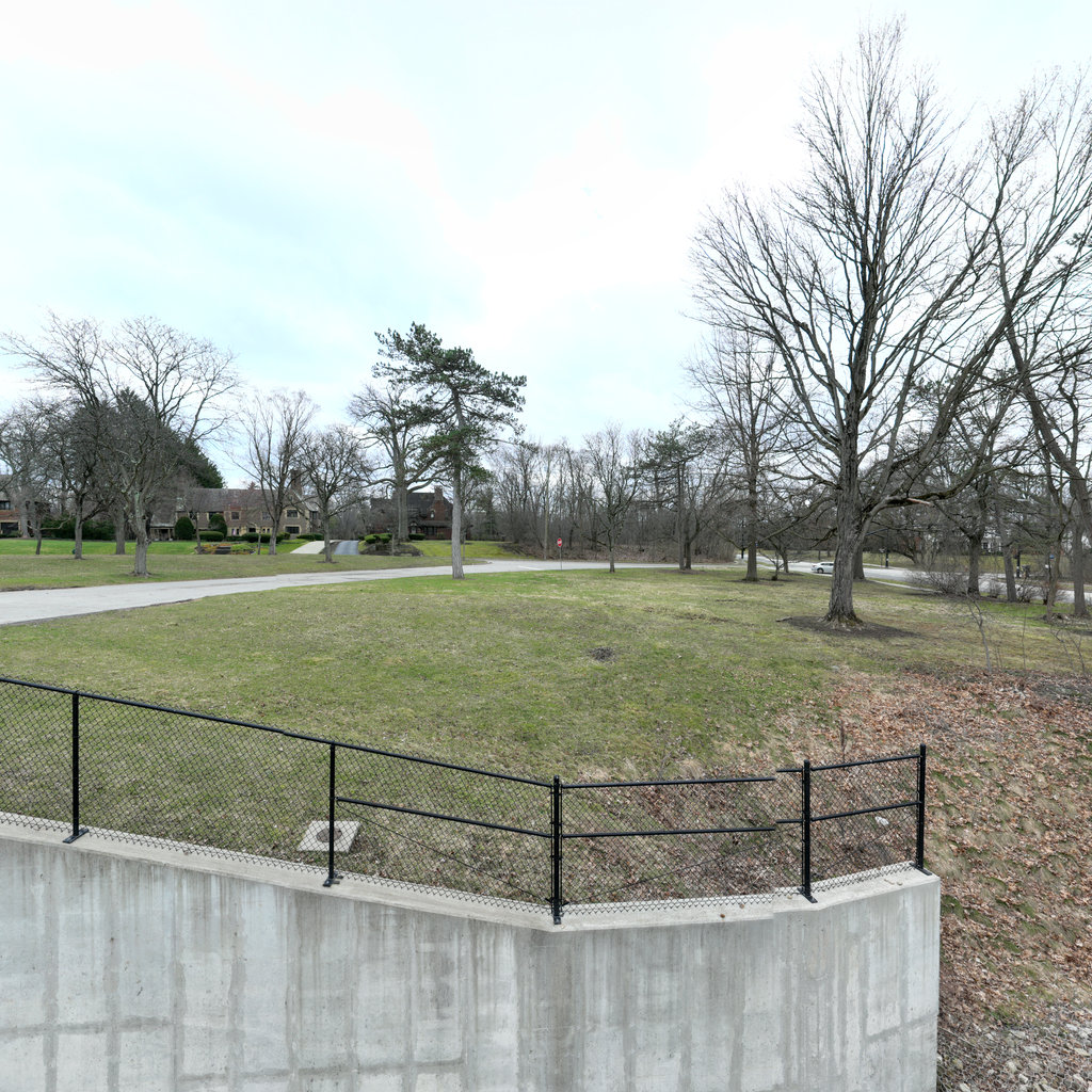
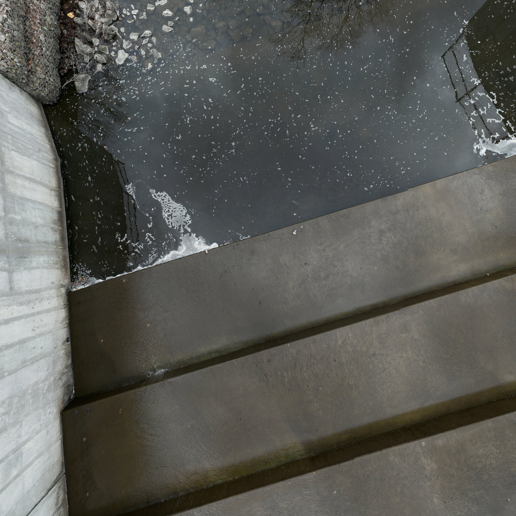
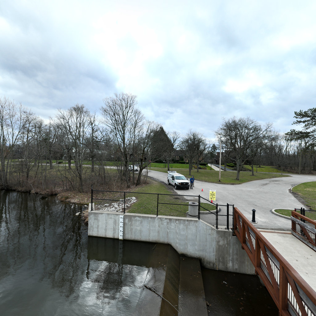
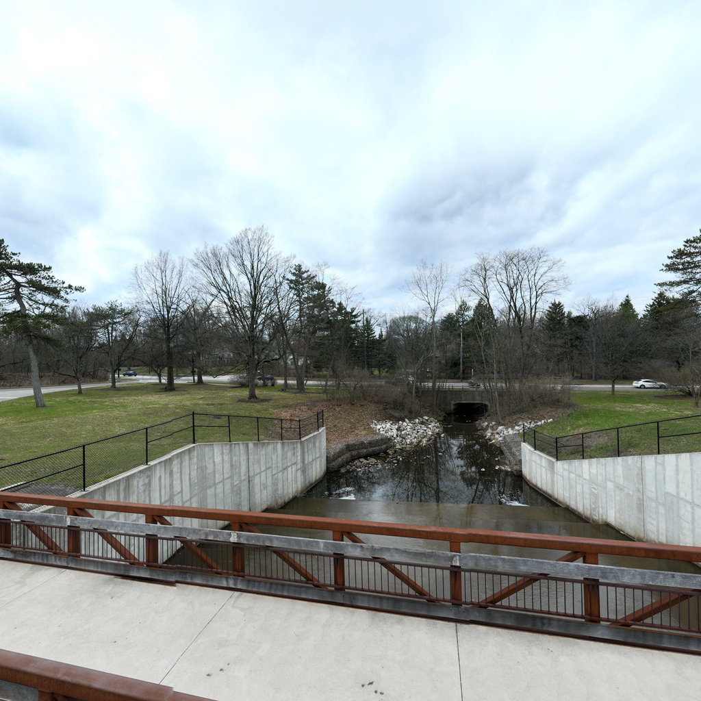
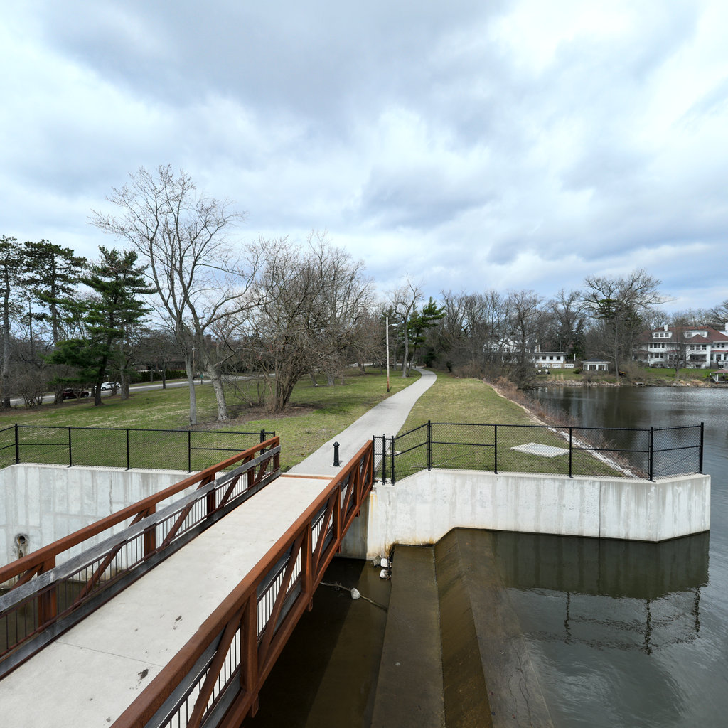
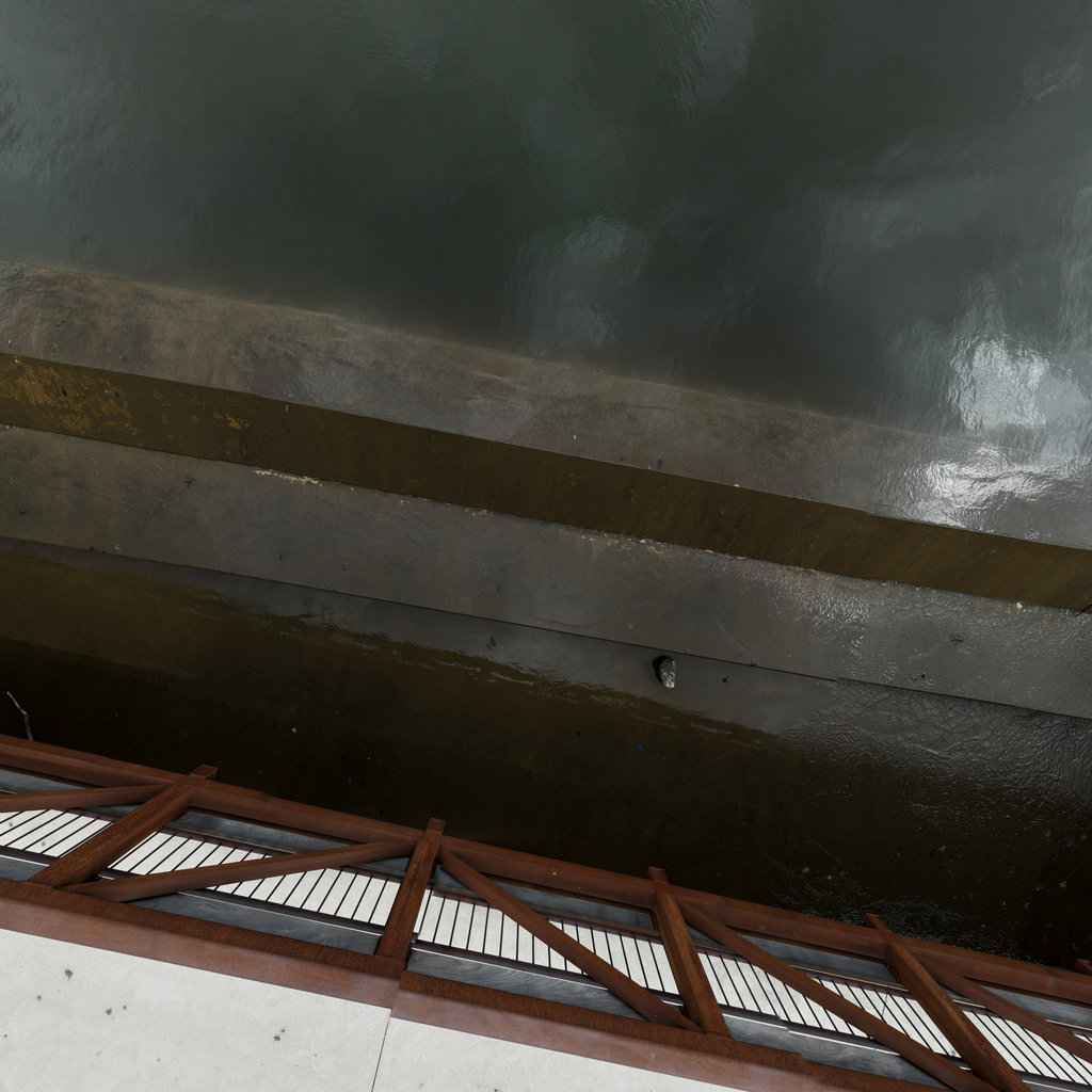
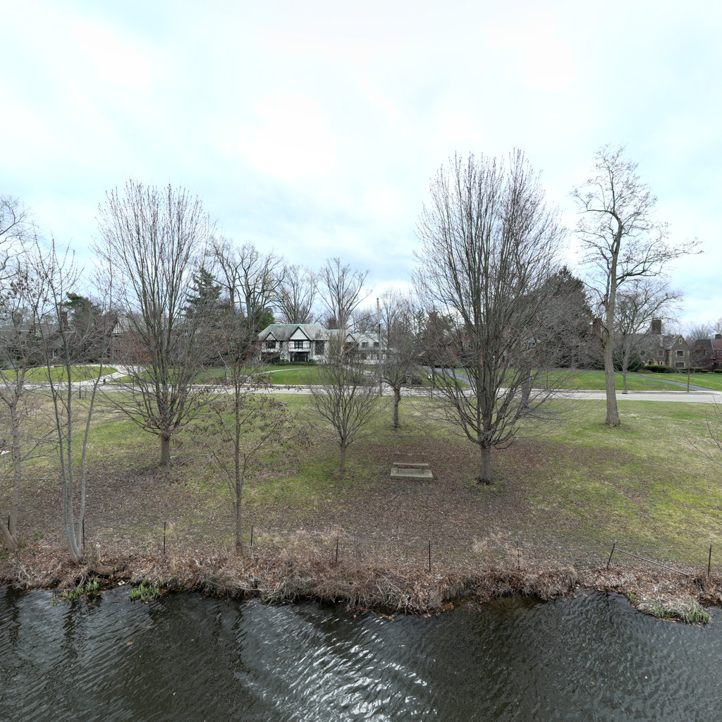
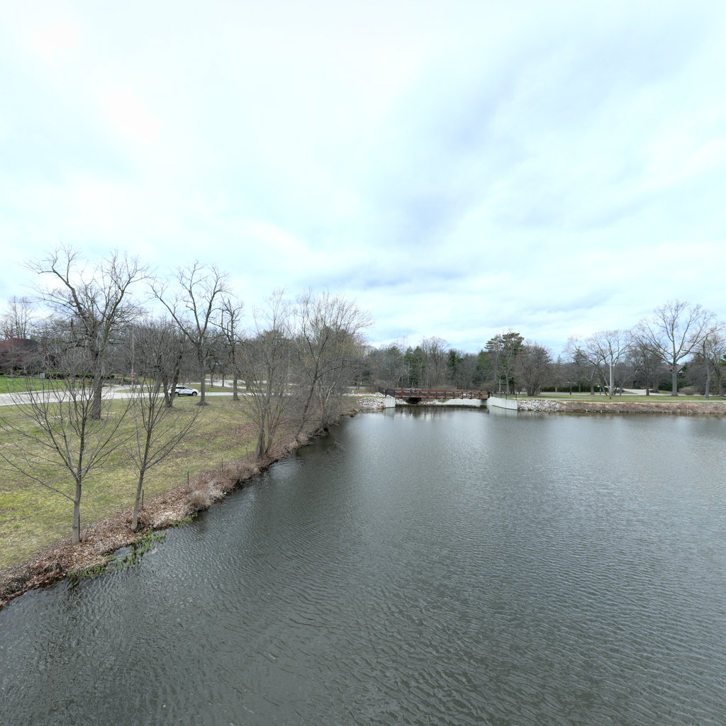
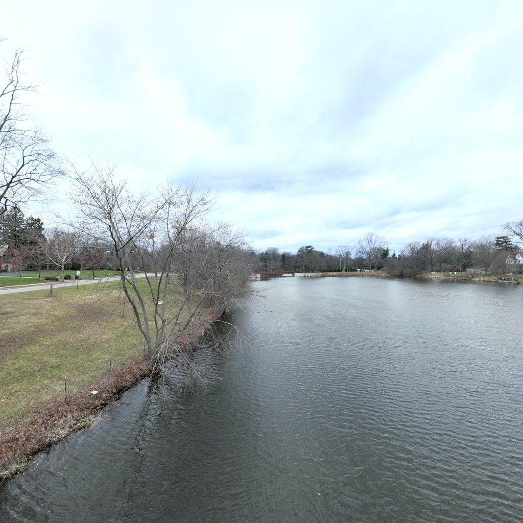
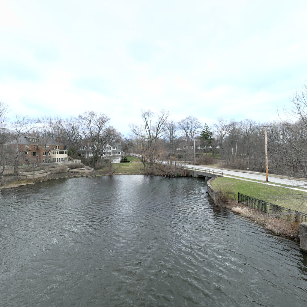
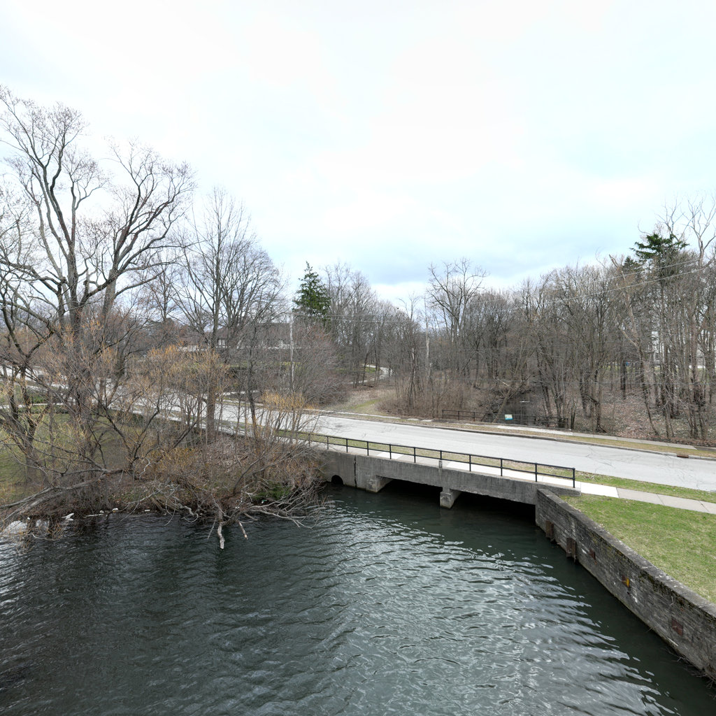
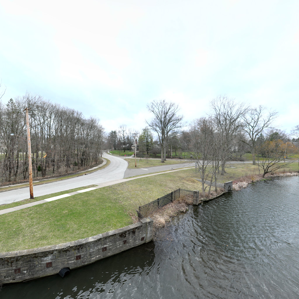
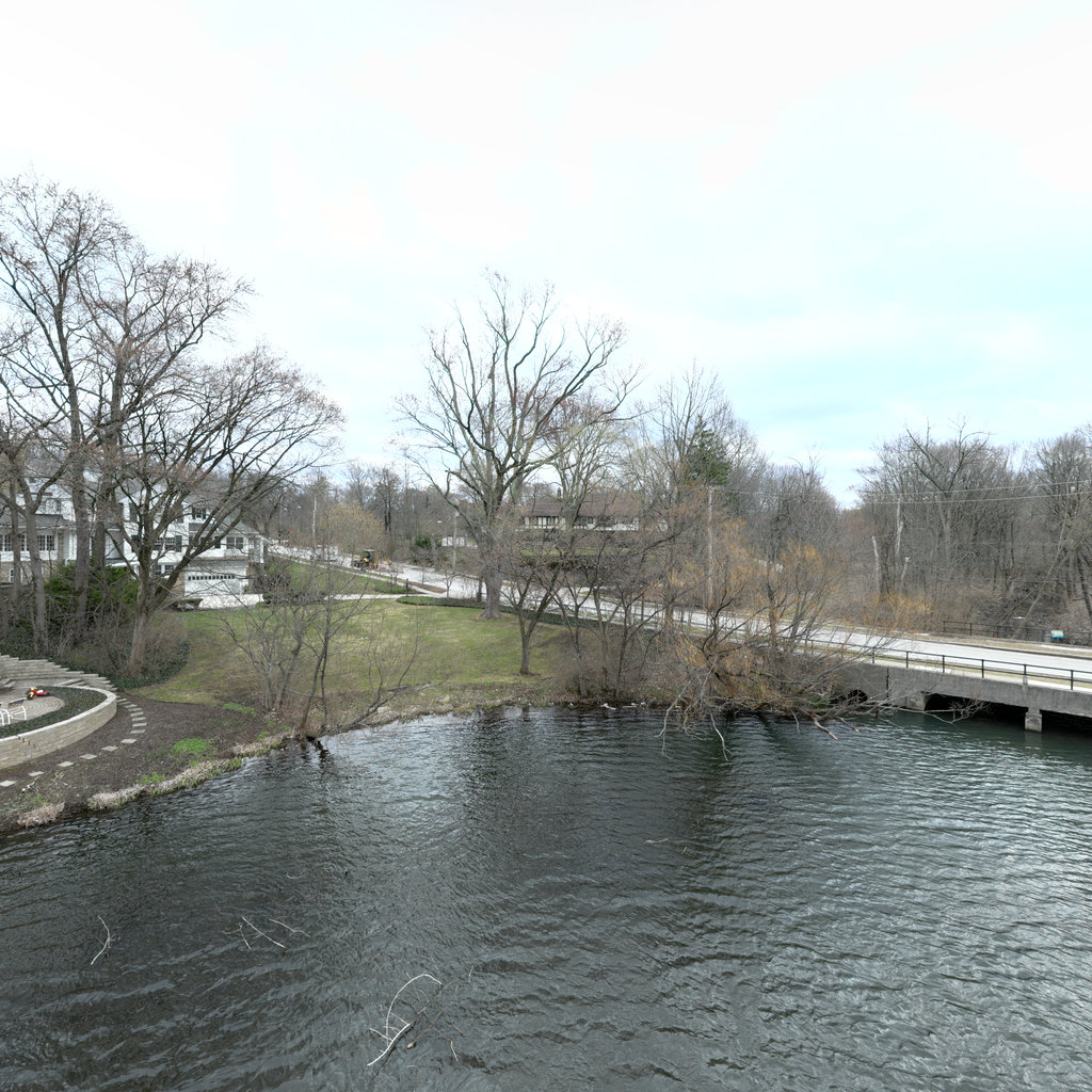
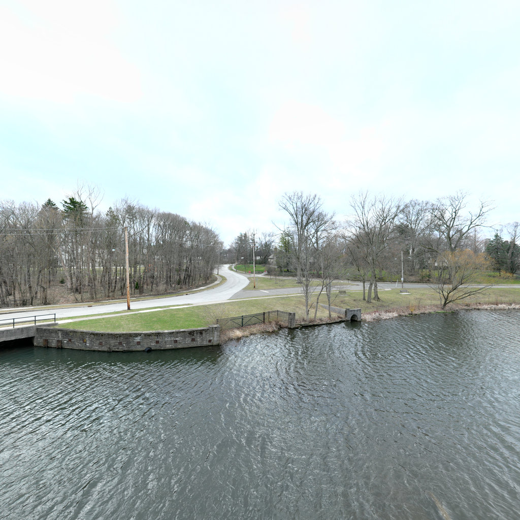
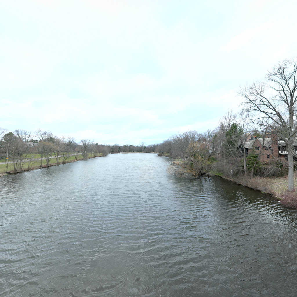
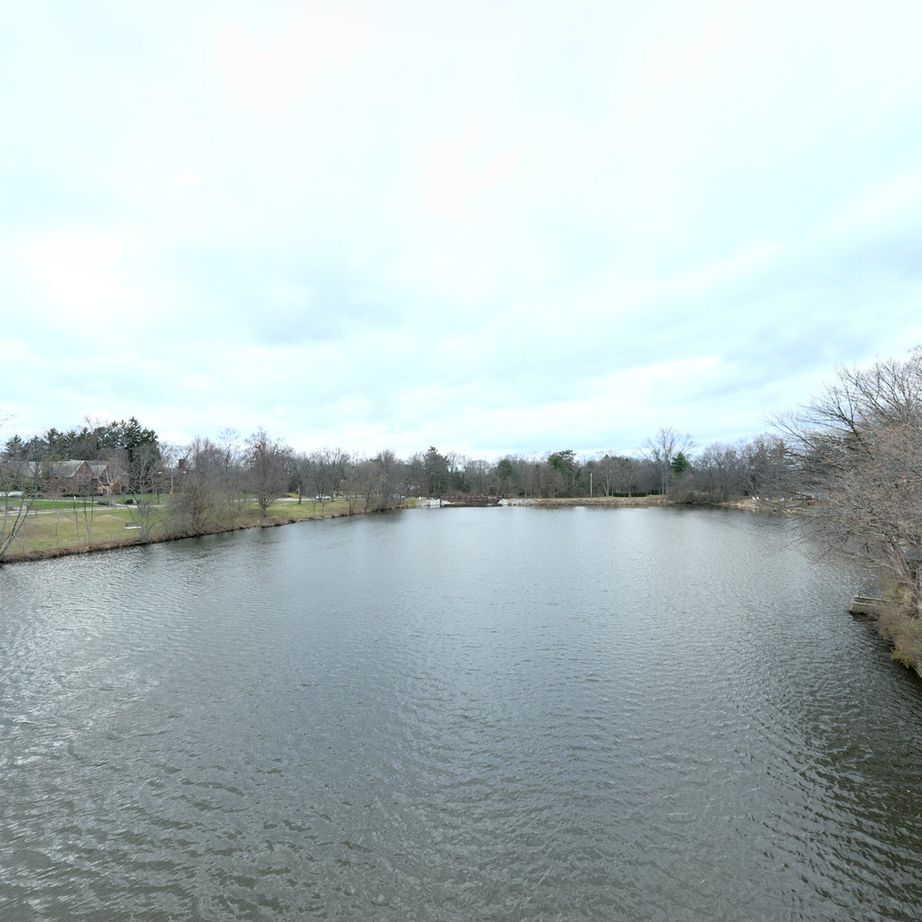
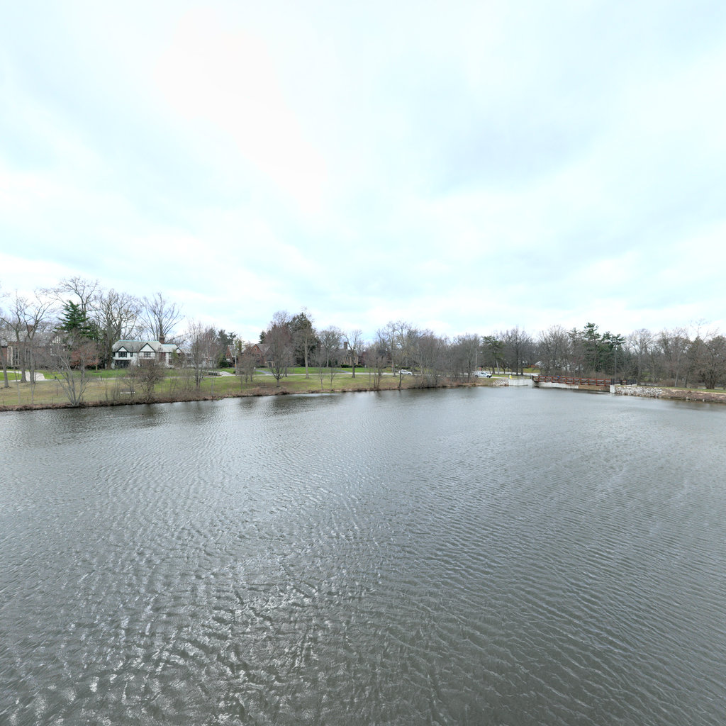
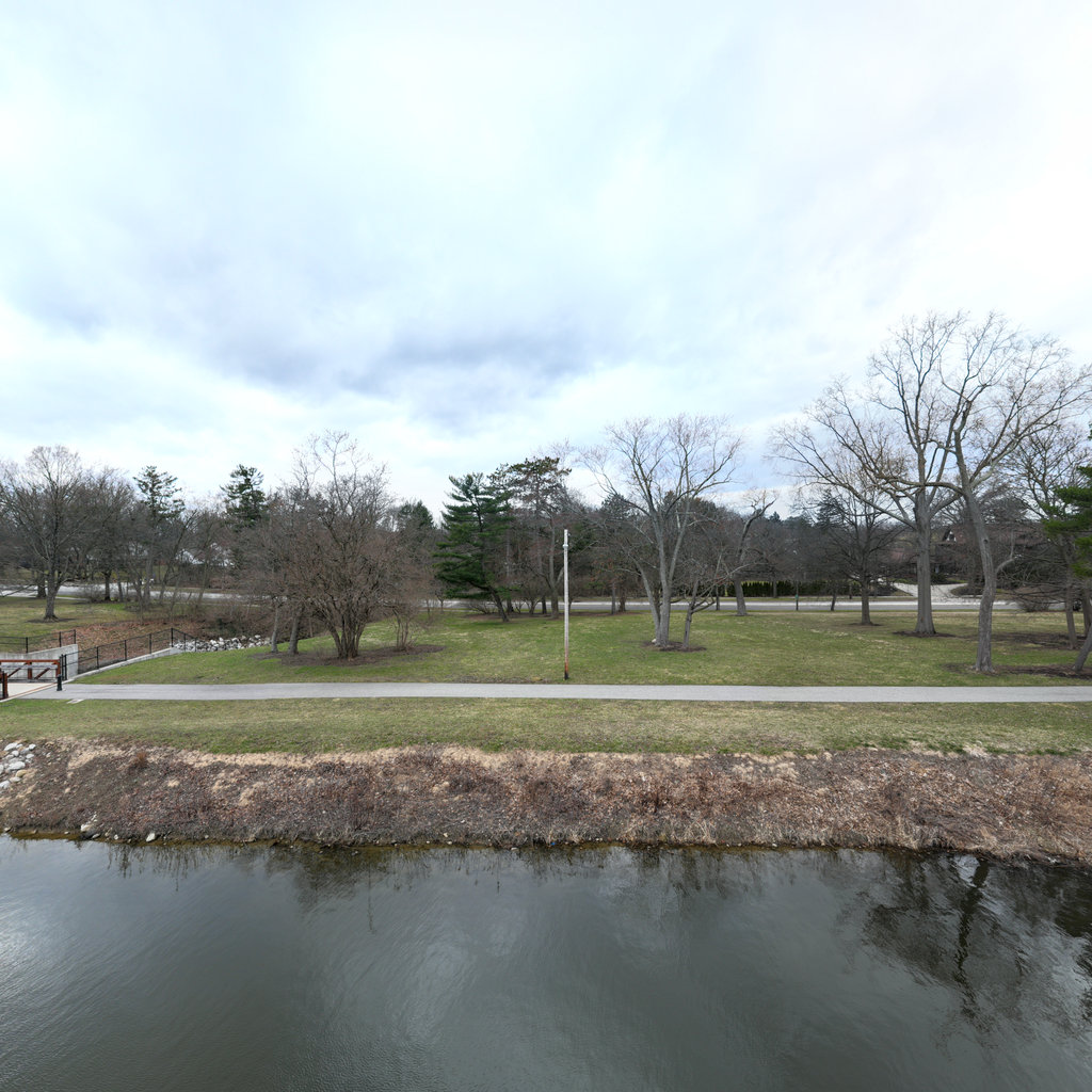
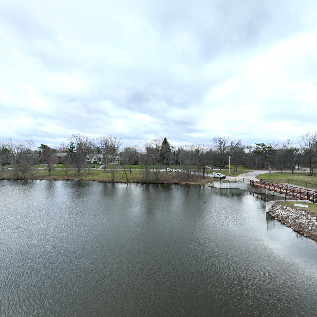
Summary: Front The front view shows a small stream or drainage channel with engineered banks and a culvert inlet beneath a pedestrian bridge. Both channel banks are armored with white riprap (4-8 inch angular stone) extending from the waterline up the slopes. Concrete retaining walls with vertical form marks contain the riprap on both sides, and the channel bed shows dark water with surface debris and floating materials suggesting recent flow events. Right The right view shows the concrete stepped weir structure and retaining wall system in detail. Multiple horizontal concrete steps descend into the water, designed for energy dissipation and flow control. A black chain-link fence tops the approximately 8-foot high concrete wall for safety. Beyond the wall, maintained turf grass slopes gently upward to a park area with dormant deciduous trees and residential development visible in the distance. Back The back view reveals the downstream side of the structure looking toward a lake or pond, with a wooden pedestrian bridge crossing the channel. The stepped concrete weir continues on this face with water flowing over the steps. Black chain-link fencing lines both sides of the elevated concrete walls. A paved parking area and maintained park grounds with dormant trees are visible on the left, while the water body extends into the distance with residential development along the far shore. Left The left view shows maintained parkland with gently sloping turf grass, mature deciduous trees in dormant condition, and the curved concrete retaining wall with black chain-link safety fencing. The wall follows a curved alignment, and leaf litter is visible on the ground surface at the base of the wall. Paved pathways and park amenities are visible in the middle ground, with residential development beyond the park area.
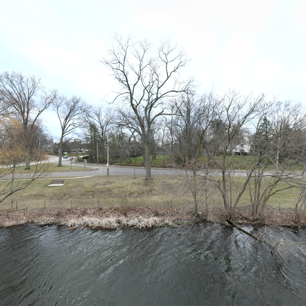
Scene #1
Erosion & Sediment Control Assessment
EXCELLENT
Front
E 87°
Right
S 177°
Back
W 267°
Left
N 357°

Up
Down
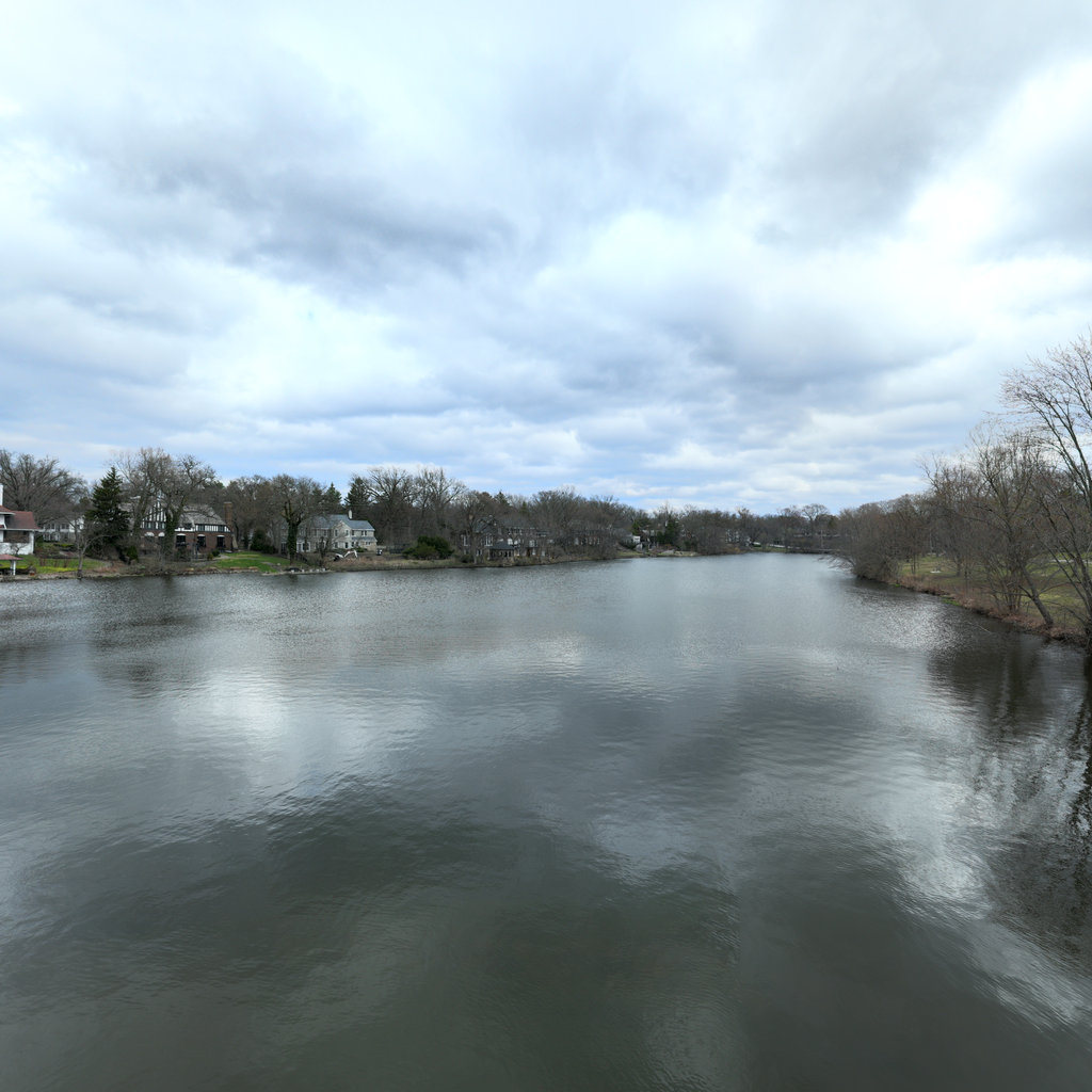
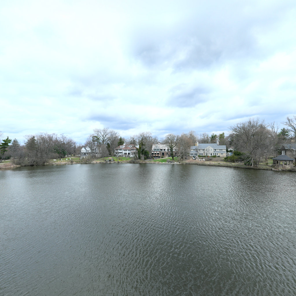
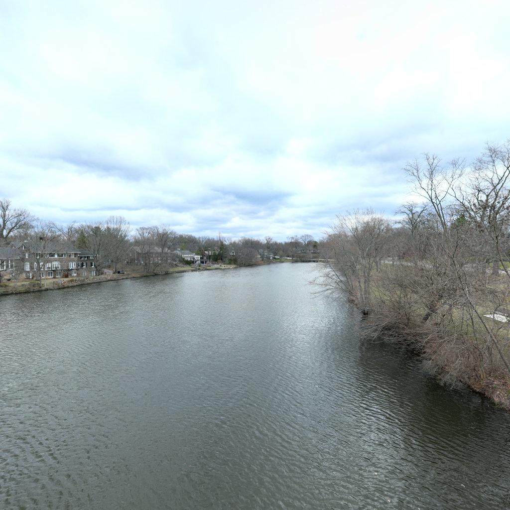
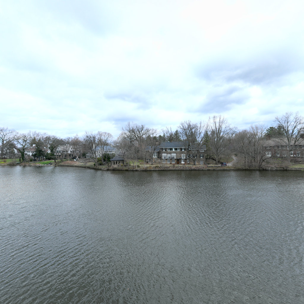
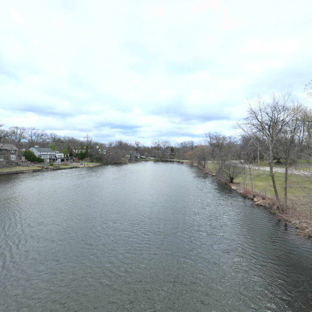
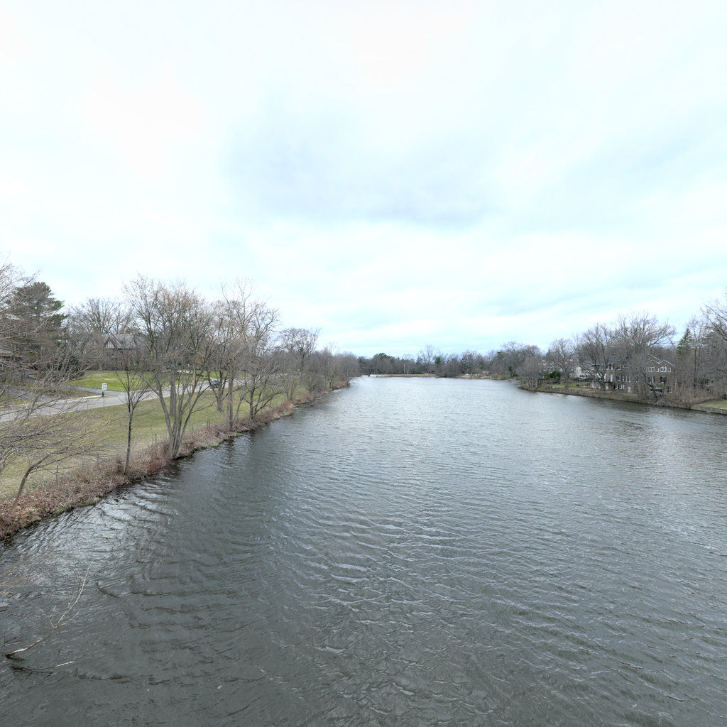
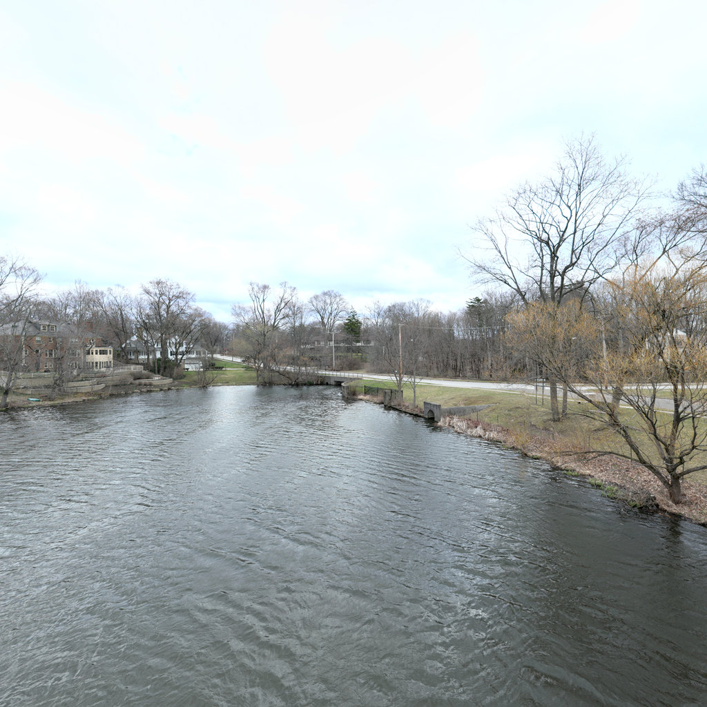
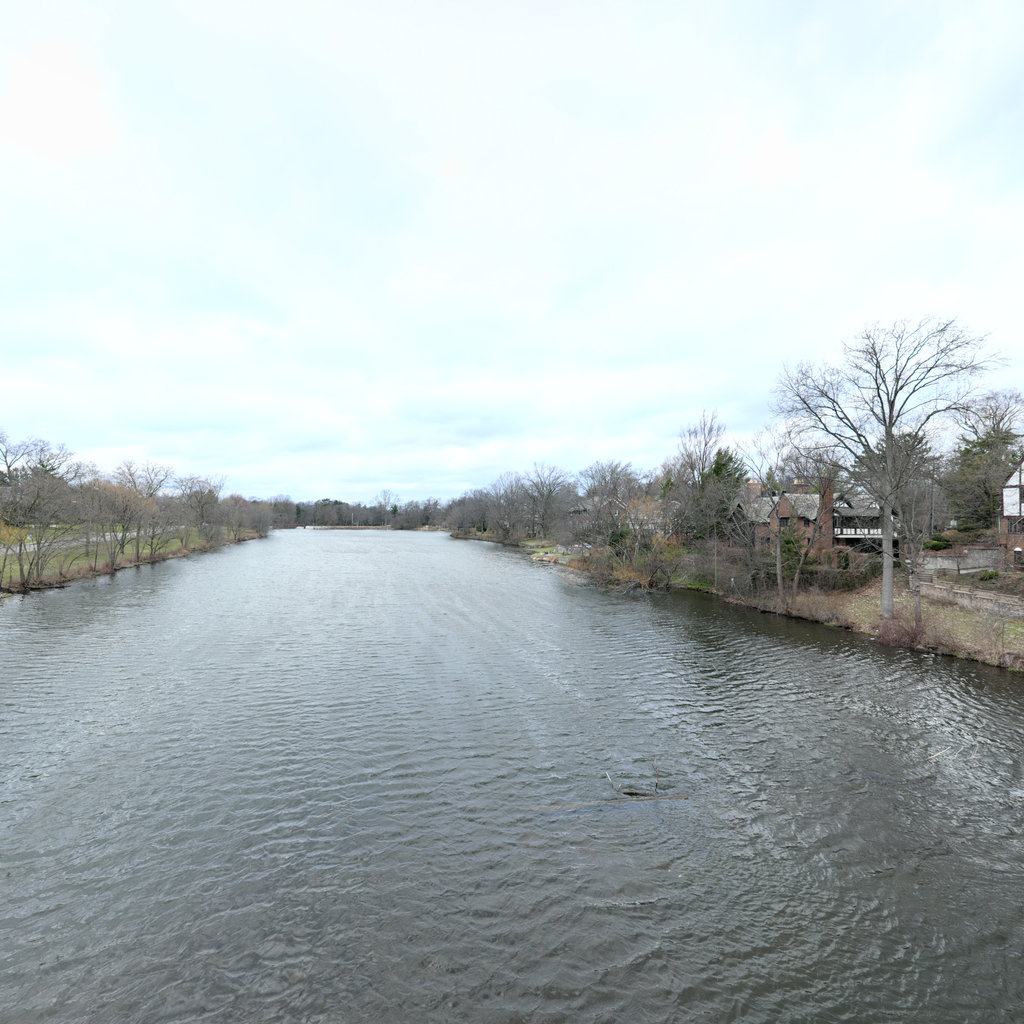
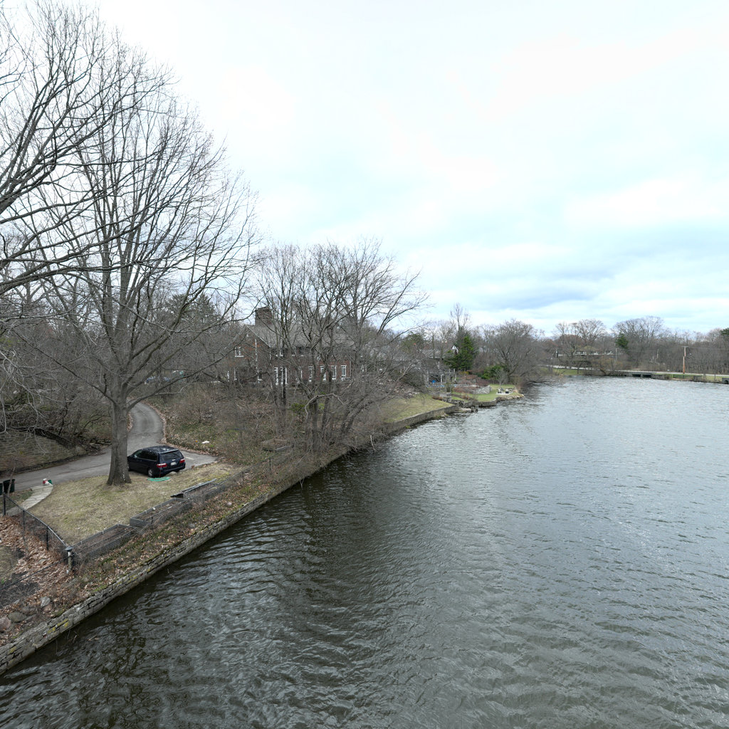
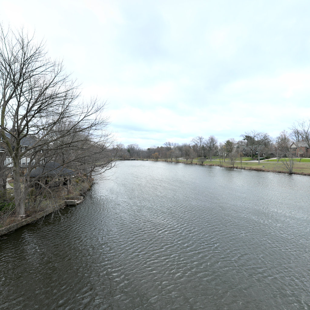
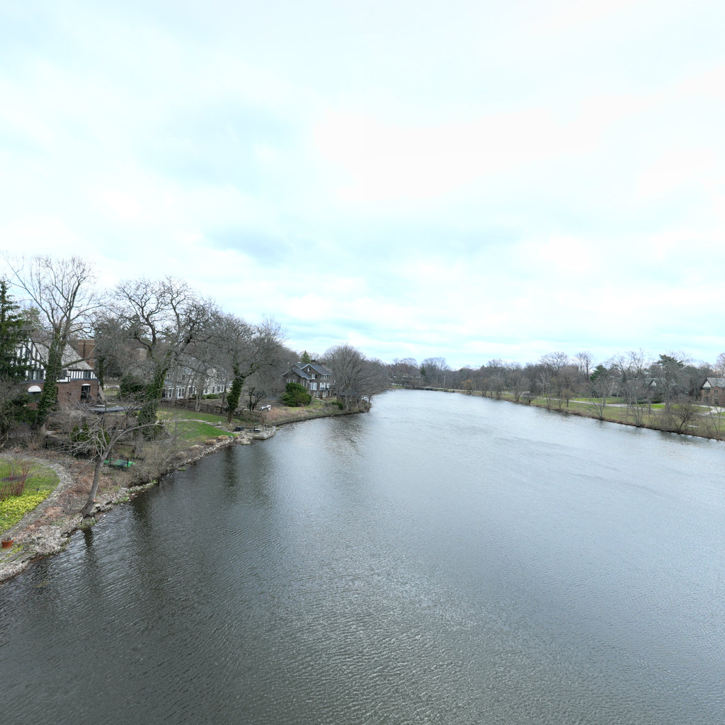
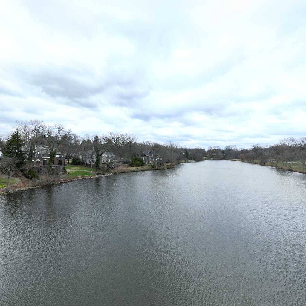
Summary: Front The front view shows a wide river or stream with calm water surface, residential properties along the left bank, and natural riparian vegetation along the right bank. The water appears slightly turbid with gray-green coloration. Dormant deciduous trees line both banks with some evergreens mixed in. Right The right view shows a concrete retaining wall with safety fencing, a concrete bridge structure with gauge markings, riprap armoring at the water's edge, and maintained park lawn beyond. A white utility vehicle and worker are visible on the access road. The channel passes under the bridge with concrete wingwalls and engineered grade control. Back The back view shows the downstream side of the pedestrian bridge with concrete channel walls, white riprap armoring, flowing water through the central channel, safety fencing, and park lawn areas with dormant trees. The concrete bridge deck and metal railings are visible above the engineered channel. Left The left view shows the upstream side of the bridge crossing with concrete deck and railings, engineered concrete retaining walls with safety fencing, maintained turf areas, pedestrian path, and dormant trees. Residential properties are visible in the background with the water body extending upstream.
Scene #2
Erosion & Sediment Control Assessment
GOOD
Front
ENE 78°
Right
SSE 168°
Back
WSW 258°
Left
NNW 348°

Up
Down
Summary: Front The front view shows a gently sloping bank transitioning from water to maintained lawn with scattered deciduous trees in dormant condition. A park bench is visible in the middle distance, with residential properties beyond. The bank exhibits moderate vegetative cover with dormant grass and leaf litter. Right The right view reveals a wider perspective of the pond system showing a small island or peninsula with constructed features including what appears to be a dock or bridge structure. Residential properties line the far shore with dormant landscaping. The near bank shows similar conditions to the front view with vegetated slopes and minor waterline erosion. Back The back view shows residential properties across the water body with maintained lawns extending to the waterline. Multiple homes are visible along the shoreline with mature deciduous trees in dormant condition. The far banks exhibit well-established vegetation with minimal visible erosion from this distance. Left The left view captures another section of the pond shoreline with residential properties visible in the distance. The near bank shows dormant woody vegetation along the waterline with sparse ground cover. This section exhibits slightly more exposed bank material compared to other views, suggesting somewhat more active wave erosion.
Scene #3
Erosion & Sediment Control Assessment
GOOD
Front
NE 54°
Right
SE 144°
Back
SW 234°
Left
NW 324°

Up
Down
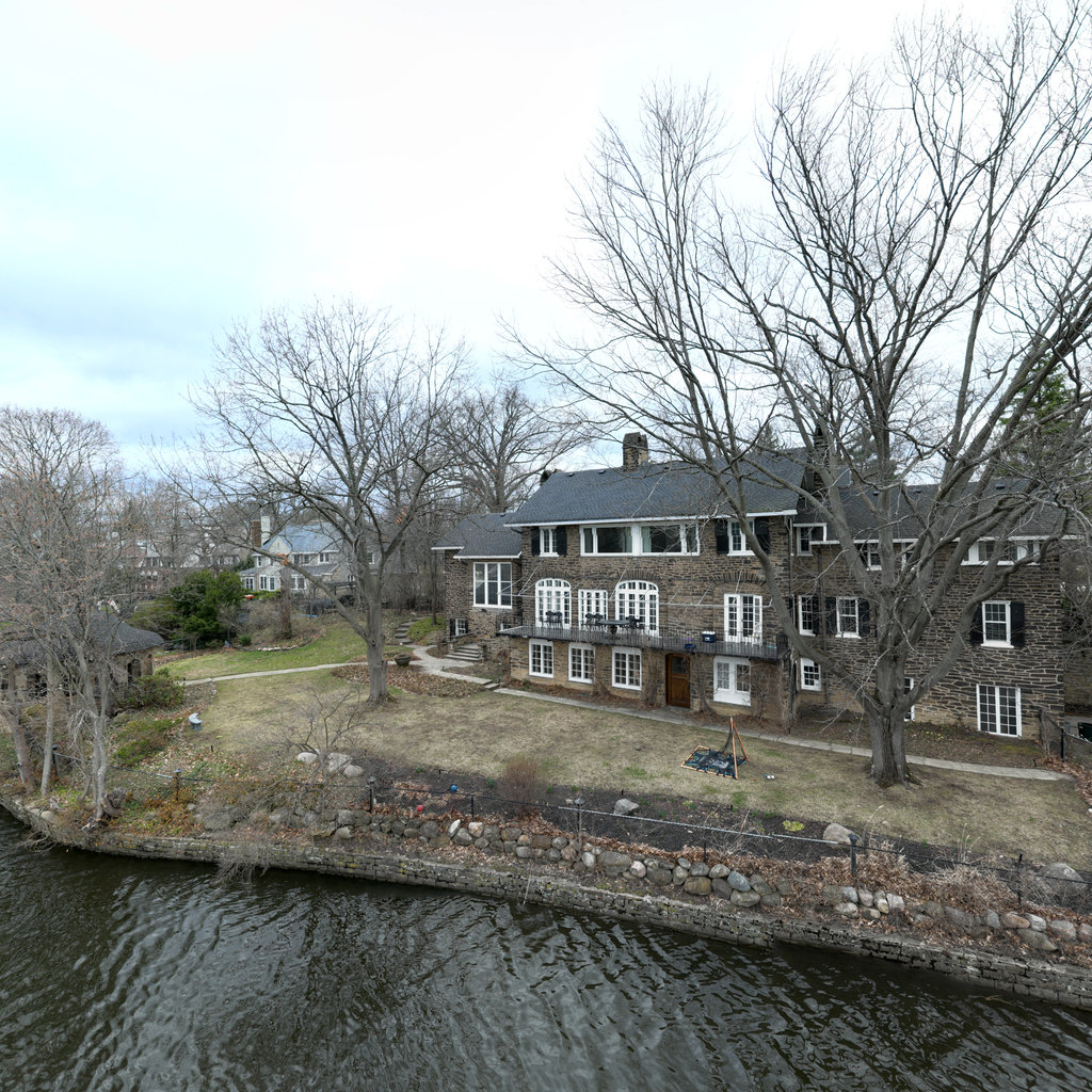
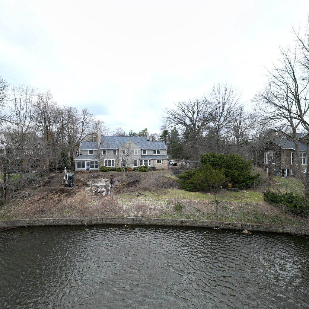
Summary: Front The front view shows a gently sloping park lawn extending upward from the water's edge to a large brick institutional building. The dormant grass bank displays minor erosion concerns with sparse vegetation cover during early spring conditions. The shoreline edge shows some organic debris accumulation and early-season bare soil exposure along the water-land interface. Right The right view shows a pond or lake with developed residential shoreline in the distance, featuring maintained lawns descending to the water. The near shoreline on the right displays dormant vegetation with organic debris at the water-land interface. The water surface appears calm and clear, with scattered trees framing the view. Back The back view shows the opposite shoreline of the water body featuring multi-story residential buildings with maintained lawns extending to the water's edge. The shoreline appears stabilized with vegetative cover, though dormant season conditions reduce protective effectiveness. The developed residential setting with riprap or structured banks is visible along much of the far shore. Left The left view shows continuation of the pond/lake system with residential development on the far shore and park-like areas on the near shore. Dormant vegetation and scattered trees frame the view. The shoreline shows minor erosion concerns with organic debris accumulation at the water-land interface, consistent with other views.
Scene #4
Erosion & Sediment Control Assessment
GOOD
Front
NNW 338°
Right
ENE 68°
Back
SSE 158°
Left
WSW 248°

Up
Down
Summary: Front The front view shows a park area with dormant grass, bare deciduous trees, and a streambank transitioning from water to maintained parkland. The immediate bank shows sparse dormant vegetation with exposed soil areas visible at the water's edge. A bench and paved pathway system is visible on the upper bank, with residential areas beyond. Right The right view looks upstream showing a wide river channel with calm water extending into the distance. Both banks show residential development with dormant riparian vegetation. The water surface appears relatively calm with slight turbidity, indicating minimal active erosion or sediment transport at this flow level. Back The back view shows the opposite bank with residential properties featuring landscaped yards, riprap armoring at the waterline, and mixed vegetation including deciduous trees and some evergreens. One property shows visible structural bank protection with stone armoring, while other areas have natural vegetated banks in dormant condition. Left The left view shows a park peninsula or point extending into the water with dormant vegetation, bare trees, and what appears to be a paved pathway system. The bank shows gentle slopes with mixed grass and shrubby vegetation in dormant condition. Some minor bare soil is visible at the waterline where the bank meets the water.
Scene #5
Erosion & Sediment Control Assessment
GOOD
Front
NW 306°
Right
NE 36°
Back
SE 126°
Left
SW 216°

Up
Down
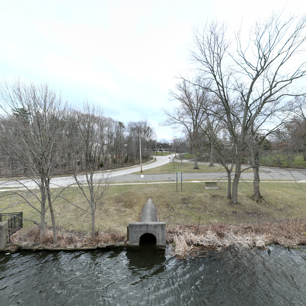
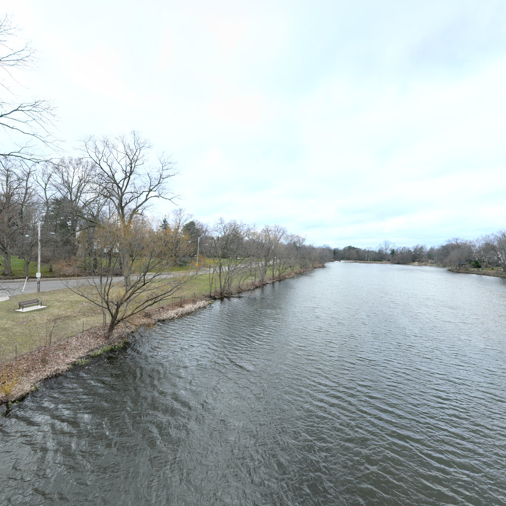
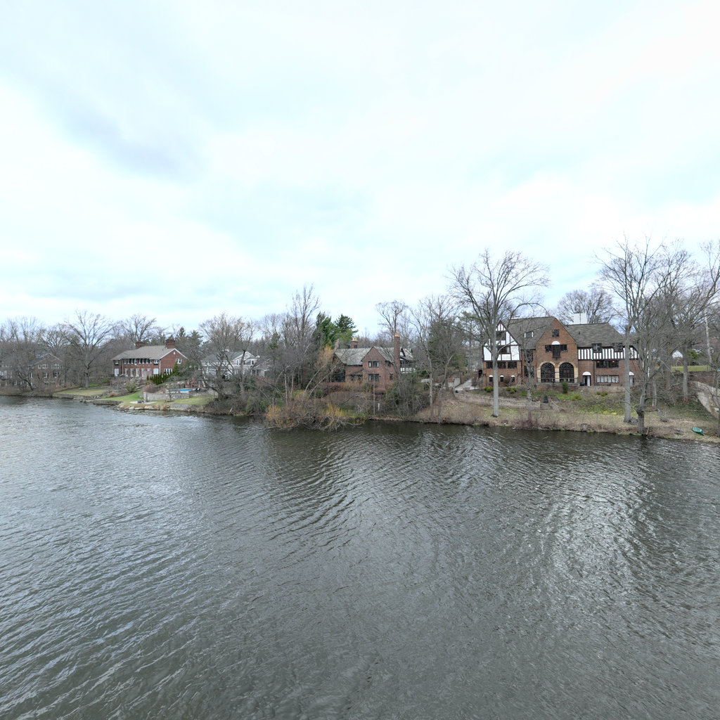
Summary: Front The front view shows a concrete culvert outfall discharging into the river, with parkland rising to a paved road beyond. Dormant grass covers the slope with scattered deciduous trees. Dead herbaceous vegetation lies along the culvert margins and immediate streambank. A fence is visible at the top left near the road. Right The right view shows an open river corridor extending downstream with residential properties visible along the left bank. The near bank features a maintained grass slope with scattered trees. Water is calm and clear, with riparian vegetation (appearing dormant/dead) along the immediate waterline. Back The back view shows residential properties on the opposite bank with mature deciduous trees and maintained lawns extending to the water's edge. A low retaining wall or stabilized bank is visible along portions of the shoreline. The area represents typical urban riparian development with large homes backing onto the waterway. Left The left view shows the continuation of urban parkland with a road bridge visible in the distance spanning the river. The near bank features maintained grass slopes with scattered deciduous trees and a metal fence along the top of the bank near the road. Dead herbaceous vegetation is visible along the immediate waterline.
Scene #6
Erosion & Sediment Control Assessment
GOOD
Front
WNW 294°
Right
NNE 24°
Back
ESE 114°
Left
SSW 204°

Up
Down
Summary: Front The front view shows a concrete bridge structure spanning the waterway, with visible dormant vegetation on both banks and deciduous trees in winter condition. The left bank shows natural vegetation and wooded slopes rising toward residential areas, while structural elements of the bridge including guardrails and abutments are prominent. Water quality appears clear with slight turbidity. Right The right view reveals a paved road corridor adjacent to the waterway with maintained grass lawn extending to the water's edge. A concrete retaining wall and fencing protect the bank edge, with residential development visible on higher ground. The infrastructure appears well-maintained with effective erosion control measures in place. Back The back view looks upstream showing the river channel extending into the distance with residential development on both banks. The water appears clear to slightly turbid, and dormant vegetation lines both banks with varying degrees of coverage. Buildings and landscaped yards are visible on both sides of the waterway. Left The left view shows residential properties with tiered retaining walls creating landscaped terraces down to the water's edge. The concrete retaining structures appear aged with some vegetation growth, and mowed lawn areas extend to property lines. The bank protection features multiple levels of engineered stabilization.
Scene #7
Erosion & Sediment Control Assessment
GOOD
Front
WNW 285°
Right
NNE 15°
Back
ESE 105°
Left
SSW 195°

Up
Down
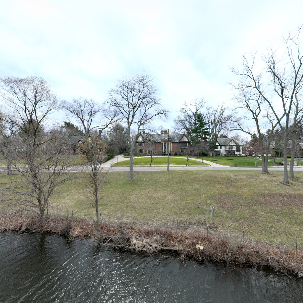
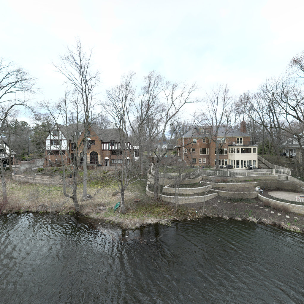
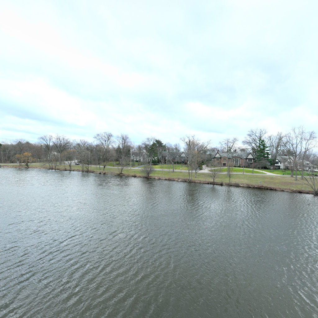
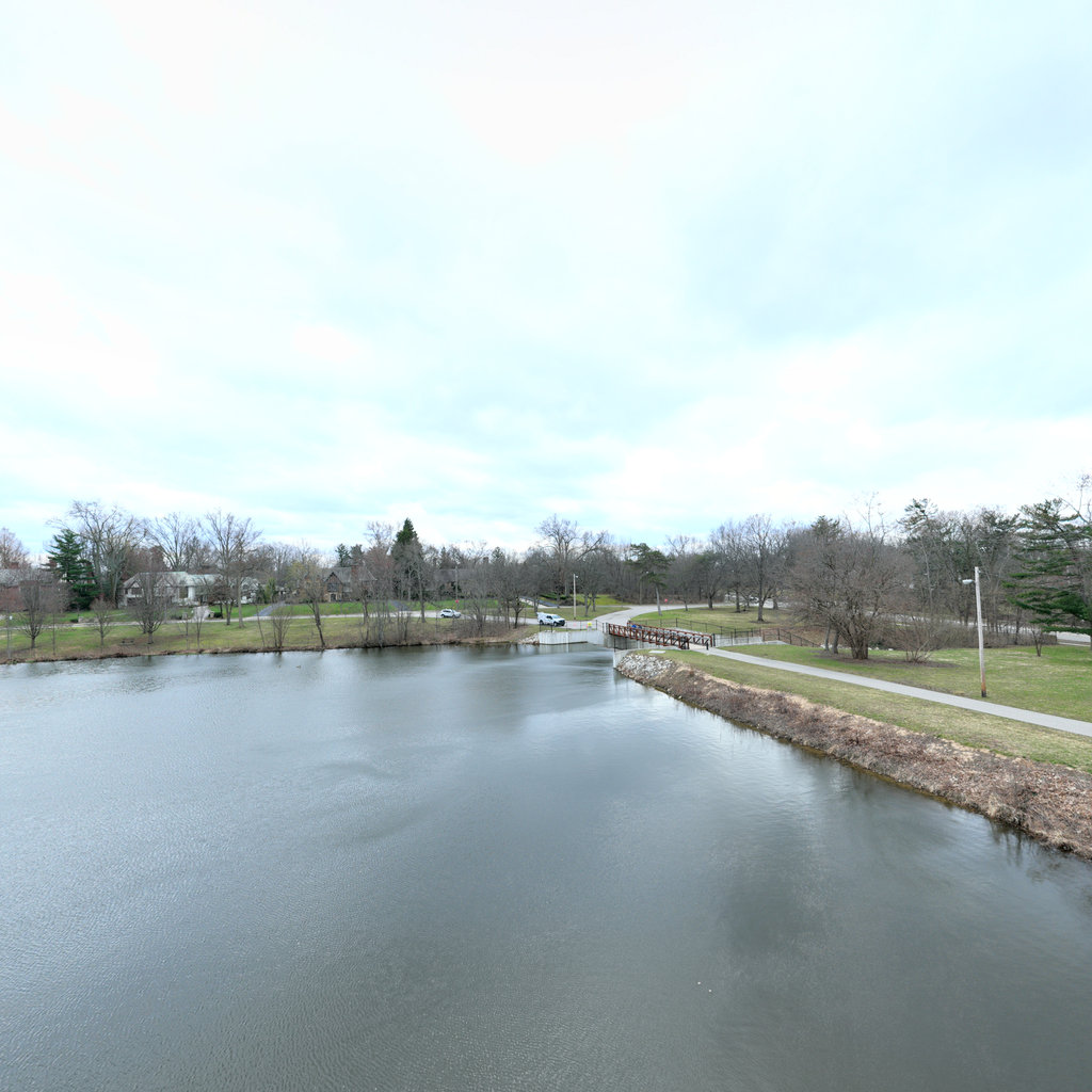
Summary: Front The front view shows residential properties with Tudor-style architecture set back from a tiered concrete retaining wall system. The bank area displays exposed soil between concrete tiers with sparse dormant vegetation, and bare deciduous trees dot the landscape. A curved driveway and ornamental fencing are visible on the upper terraces. Right The right view reveals a curving road with bridge infrastructure crossing the water body. A terraced concrete retaining wall system continues along the bank with exposed soil areas between tiers. The parkland shows dormant grass cover, scattered trees, and a metal fence delineating the property boundary. Back The back view shows the open water channel extending upstream with residential properties on both banks. Dormant riparian vegetation lines the banks, with a mix of deciduous trees and some evergreens. The water appears calm with slight turbidity and the channel is well-defined. Left The left view displays a concrete retaining wall with curved design at the waterline, adjacent to a paved road and bridge structure. The parkland area shows dormant turf grass with scattered deciduous trees and a drainage culvert or outlet near the water's edge.
Scene #8
Erosion & Sediment Control Assessment
GOOD
Front
W 273°
Right
N 3°
Back
E 93°
Left
S 183°

Up
Down
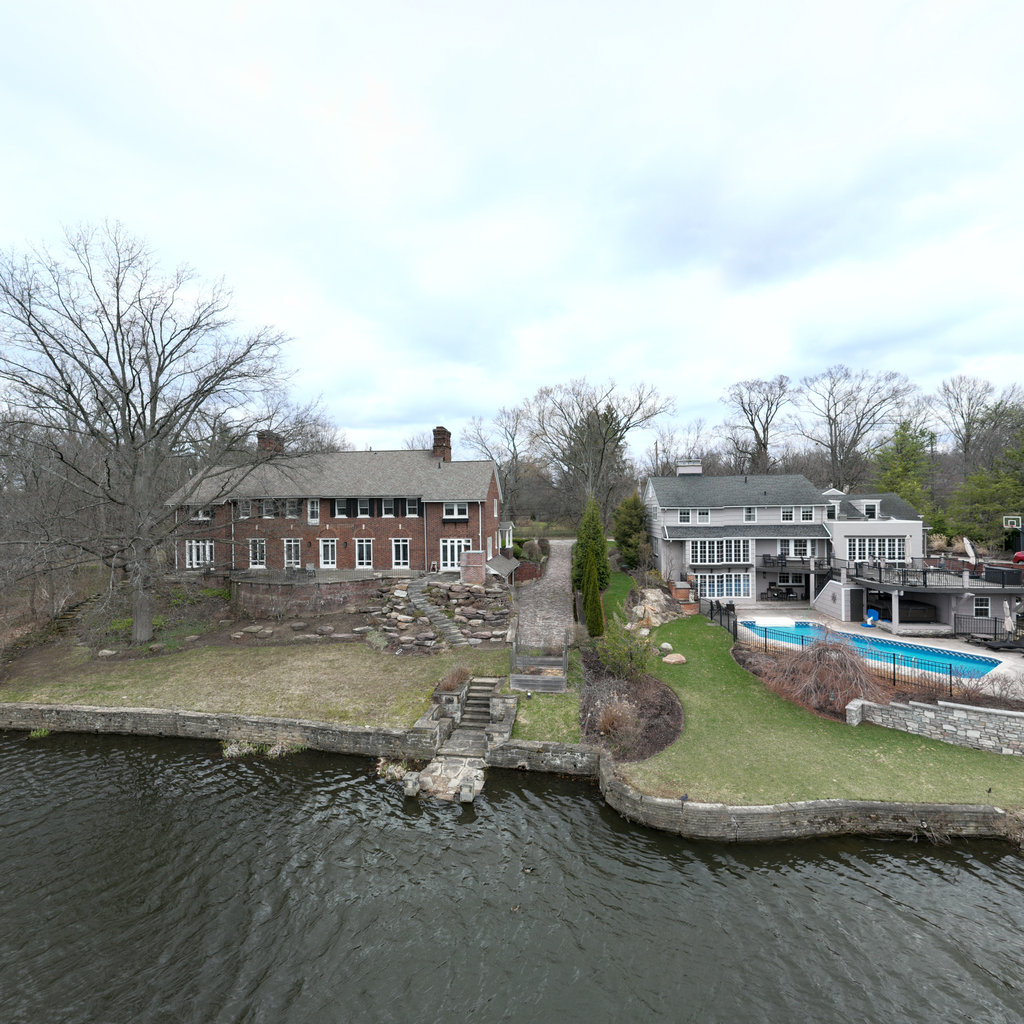
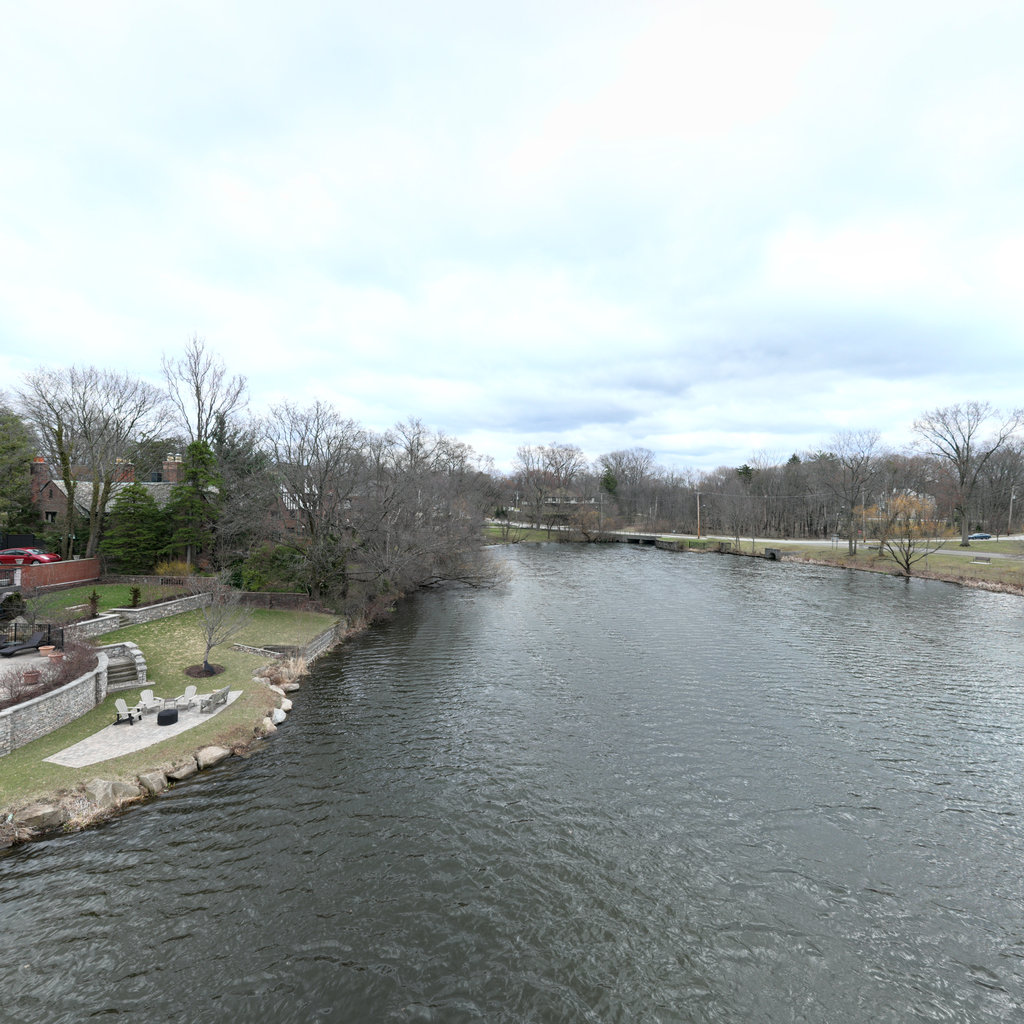
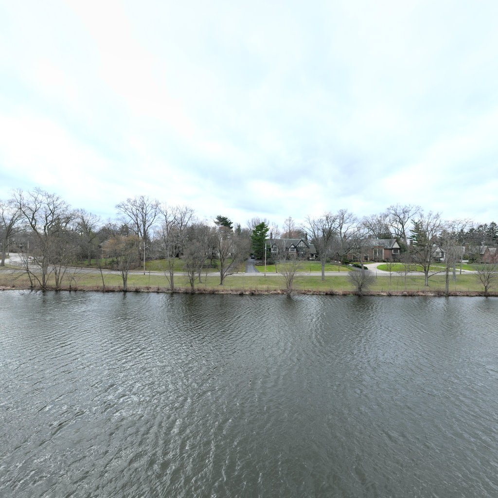
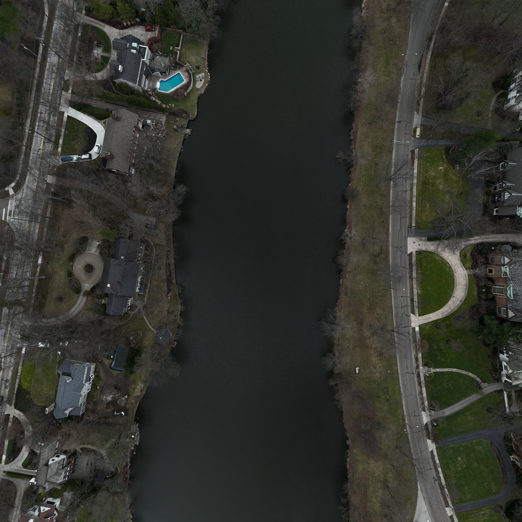
Summary: Front Front view shows residential properties along the left (south) bank with a prominent swimming pool, retaining walls, and mature deciduous trees in dormant condition. The right bank displays natural vegetation with bare deciduous trees and some evergreens. The waterway appears calm with no visible erosion features in this view. Right Right view shows residential development on the right bank with a bridge/road crossing visible in the distance. The left bank displays natural riparian vegetation with bare deciduous trees. Water surface is calm with slight ripples, and both banks appear well-vegetated with no significant erosion. Back Back view reveals open waterway extending into distance with residential development on both sides. Banks show gentle slopes with mixed grass and dormant trees. A road is visible along the left bank with utility poles. Water surface is calm with no visible turbidity or sediment. Left Left view shows low-lying riparian area with sparse dormant trees partially submerged at their bases, indicating recent high water levels or seasonal flooding. The background shows residential development and roadway. Banks appear gently sloped with grass and scattered trees in dormant condition.
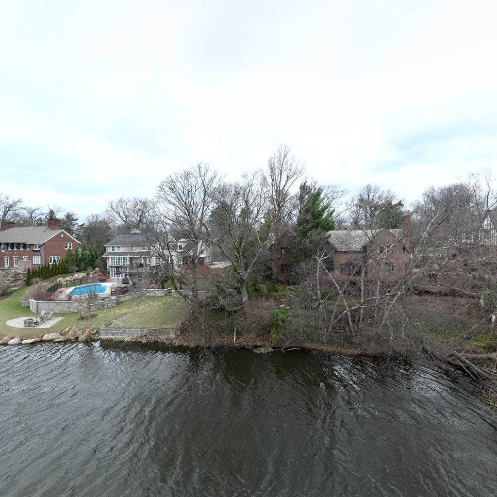
Scene #9
Erosion & Sediment Control Assessment
EXCELLENT
Front
WSW 250°
Right
NNW 340°
Back
ENE 70°

Left
SSE 160°

Up
Down
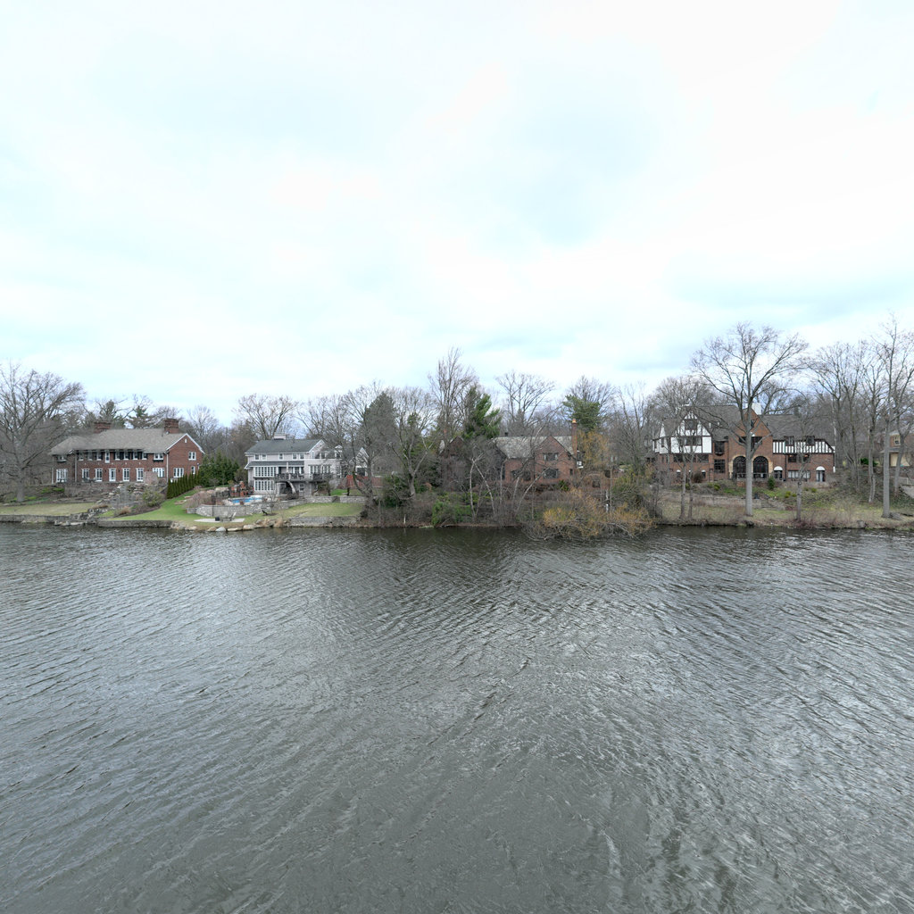
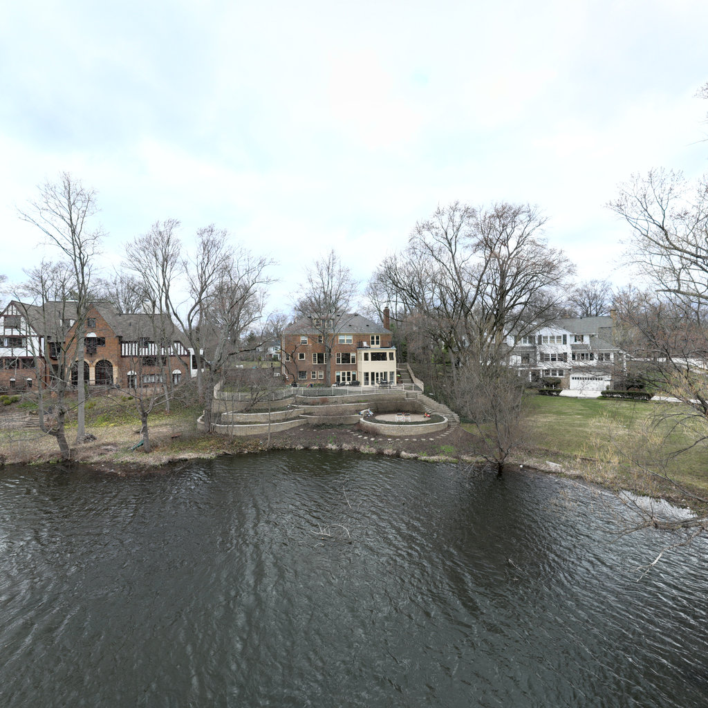
Summary: Front The front view shows residential waterfront properties with well-maintained lawns sloping to stone-armored shorelines. Two substantial residential structures are visible - a red brick building on the left and a modern gray house with large windows on the right. The properties feature engineered stone retaining walls and minimal exposed soil, indicating long-established shoreline stabilization. Right The right view continues along the residential waterway showing a wide, calm water channel extending upstream. Multiple residential properties line the right bank with maintained lawns and mature deciduous trees. A bridge or road crossing is visible in the distance, and the channel appears well-established with stable banks. Back The back view shows the downstream direction with similar residential development on both banks. The channel widens slightly with a grassy area and trees lining the left bank and residential structures on the right. Banks appear well-vegetated and stable with no visible erosion features. The waterway appears to be part of an established residential canal or managed river system. Left The left view shows continued residential waterfront with a prominent red brick multi-story building on the right bank. The left bank features maintained lawns with mature trees and a paved area visible. The channel continues with calm water and well-stabilized banks showing no erosion. A bridge structure is visible in the distance connecting across the waterway.
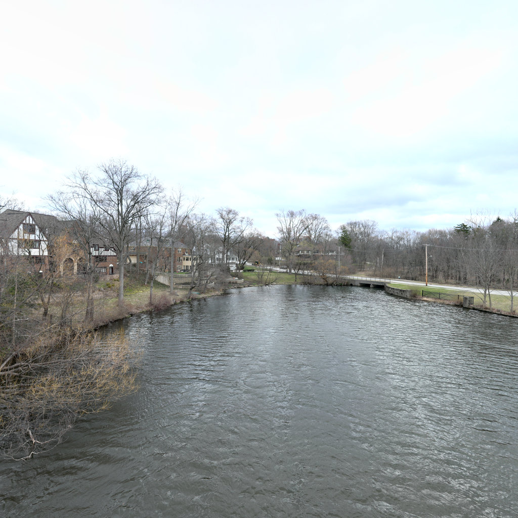
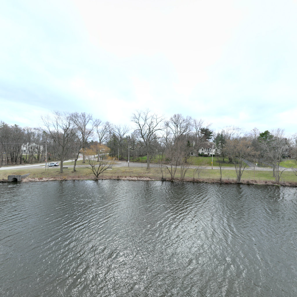
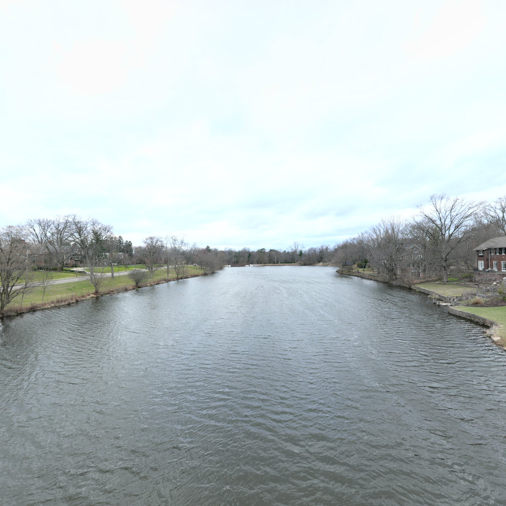
Scene #10
Erosion & Sediment Control Assessment
GOOD
Front
S 188°
Right
W 278°
Back
N 8°
Left
E 98°

Up

Down
Summary: Front The front view shows a large stone residential building with mature deciduous trees in dormant condition. The immediate shoreline features visible rock armoring along the water's edge with sparse dormant vegetation on the adjacent lawn area. A retaining feature is visible at the base of the bank with some localized bare soil patches in the lawn area. Right The right view shows continuation of the waterfront corridor with a curved shoreline featuring riprap protection. A paved driveway or access road is visible leading to the residential area. The shoreline vegetation is dormant with scattered trees and maintained turf grass extending to the water's edge protection structures. Back The back view shows an expansive water body (lake or wide river) with residential development visible on the opposite shore. Multiple parcels with maintained lawns and tree cover line the distant shoreline. The water surface appears calm and clear with no visible turbidity or sediment plumes. Left The left view shows additional residential waterfront with maintained parkland or yard areas extending to the water's edge. Dormant deciduous trees are scattered throughout with open lawn areas. The shoreline appears gently sloped with some low-level vegetation at the water interface. A portion of flooded or wetland area is visible near the shore.
Scene #11
Erosion & Sediment Control Assessment
FAIR
Front
SE 143°
Right
SW 233°
Back
NW 323°
Left
NE 53°

Up
Down
Summary: Front The front view shows a residential property with significant bank modifications including disturbed soil areas, construction activity, and engineered shoreline features. A two-story stone residence sits atop a modified slope with visible bare soil patches, construction equipment, and riprap armoring at the water's edge. The bank exhibits a mix of vegetated and bare areas with evidence of recent grading and landscaping work. Right The right view reveals open water with residential properties lining the far shore, showing mature deciduous trees in dormant condition and established lawns extending to water's edge. The shoreline appears relatively stable with vegetated banks and no significant erosion features visible at this distance. Water surface is calm with minor ripples. Back The back view shows the continuation of the waterway with residential properties on both sides, mature trees along shorelines, and a visible bridge or water control structure in the middle distance. The shoreline exhibits mixed conditions with vegetated areas and some structural features. Water remains clear and calm. Left The left view displays residential waterfront with stone retaining walls, paved surfaces at water's edge, and mature landscaping including evergreen and deciduous trees. The shoreline is heavily engineered with hardscape features, docks, and armoring structures. Properties show active residential use with maintained landscapes.
Scene #12
Erosion & Sediment Control Assessment
GOOD
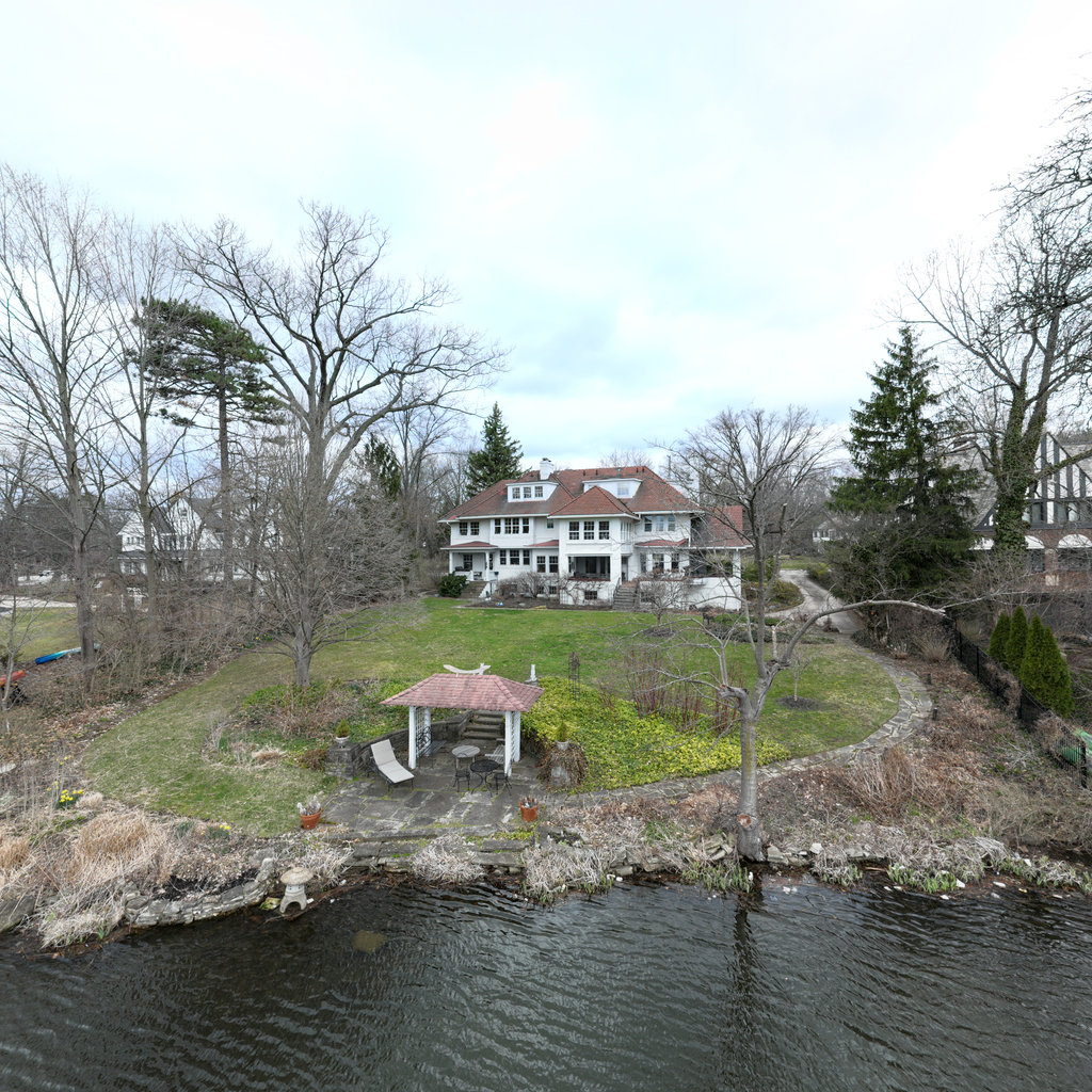
Front
SE 125°
Right
SW 215°
Back
NW 305°
Left
NE 35°

Up
Down
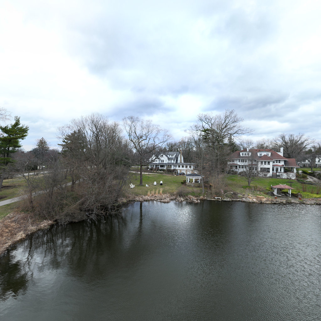
Summary: Front The front view shows a large residential property with a white gazebo structure at the water's edge, backed by a substantial two-story home with dormers. The shoreline features constructed stone/concrete edge treatment with vegetation on the slope leading to the lawn. Dormant season vegetation is visible throughout the yard with mature deciduous trees (leafless) and evergreens framing the property. Right The right view reveals a wider expanse of the water body with additional residential properties visible along the far shore. The near shoreline continues to show constructed edge treatment with sparse vegetation at the waterline. Multiple residential structures are visible in the distance, and a peninsula or point of land extends into the water on the right side of the view. Back The back view shows a panoramic vista across the pond/lake toward the opposite shore with multiple residential properties, a park-like setting, and what appears to be a pedestrian bridge or dock structure on the right side. The far shoreline displays gentle slopes with maintained lawns transitioning to the water, interspersed with deciduous and evergreen trees in dormant condition. Left The left view shows another residential property along the shoreline with sparse dormant vegetation and exposed rock/concrete stabilization features at the waterline. A small dock or platform structure is visible extending into the water, and the shoreline shows areas of limited vegetation coverage between the water and maintained lawn areas.
Scene #13
Erosion & Sediment Control Assessment
GOOD
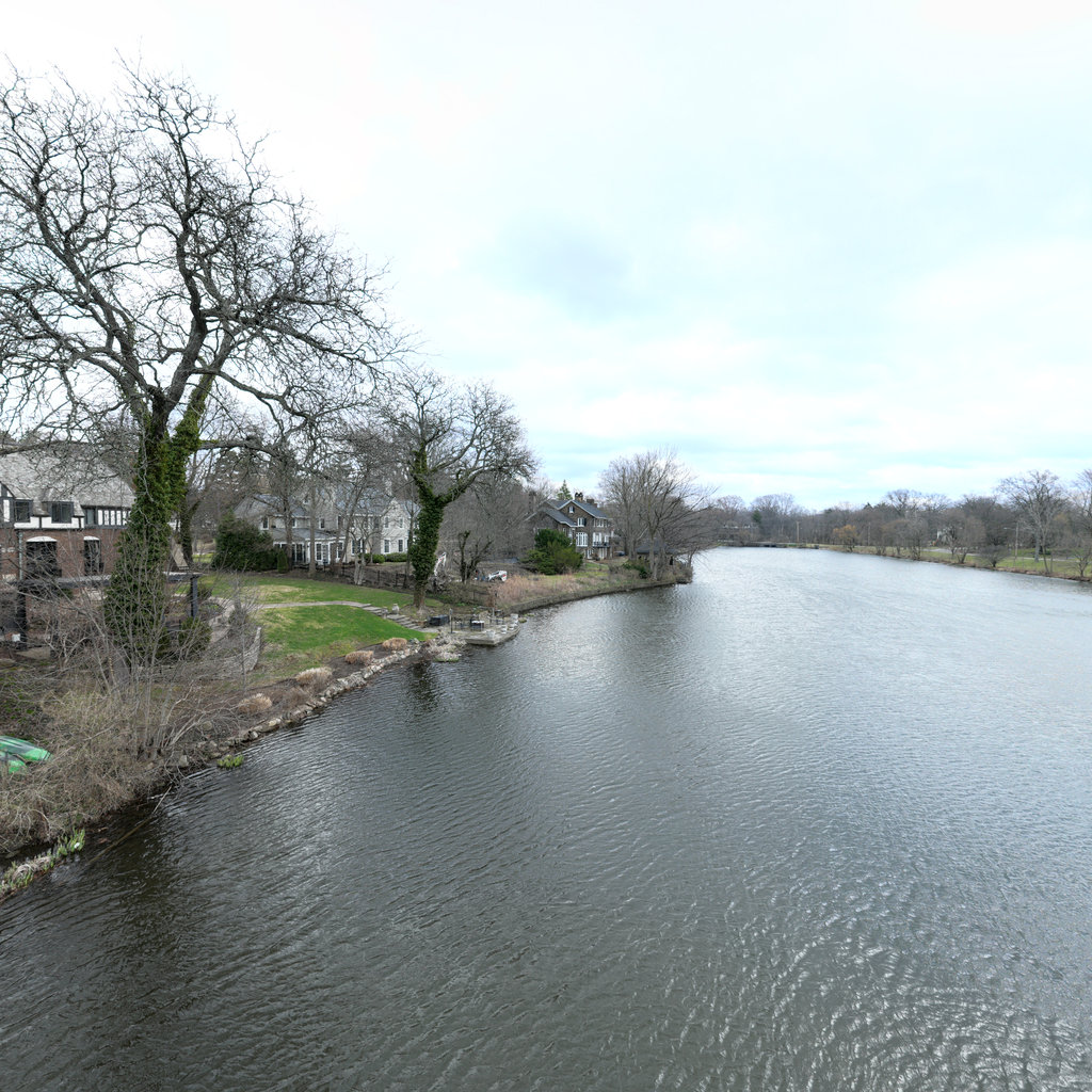
Front
ESE 117°
Right
SSW 207°
Back
WNW 297°
Left
NNE 27°

Up
Down
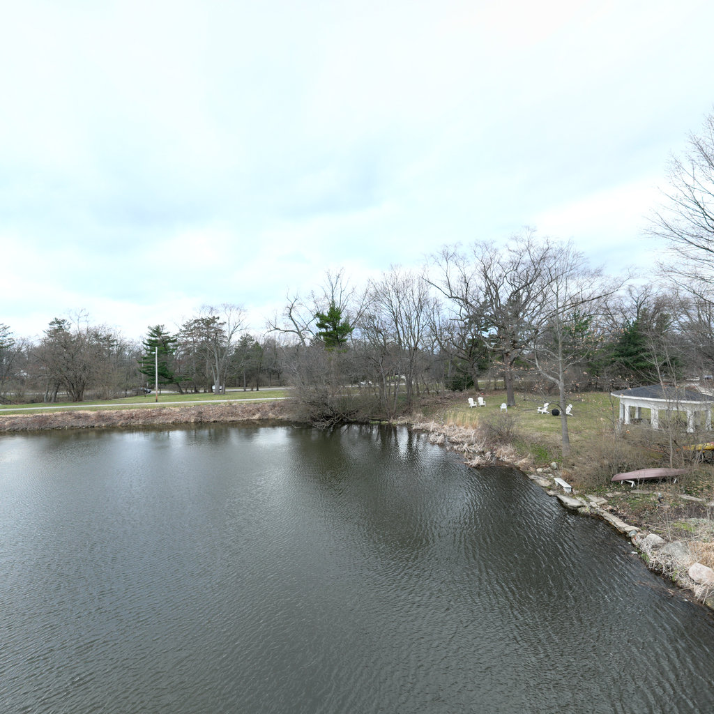
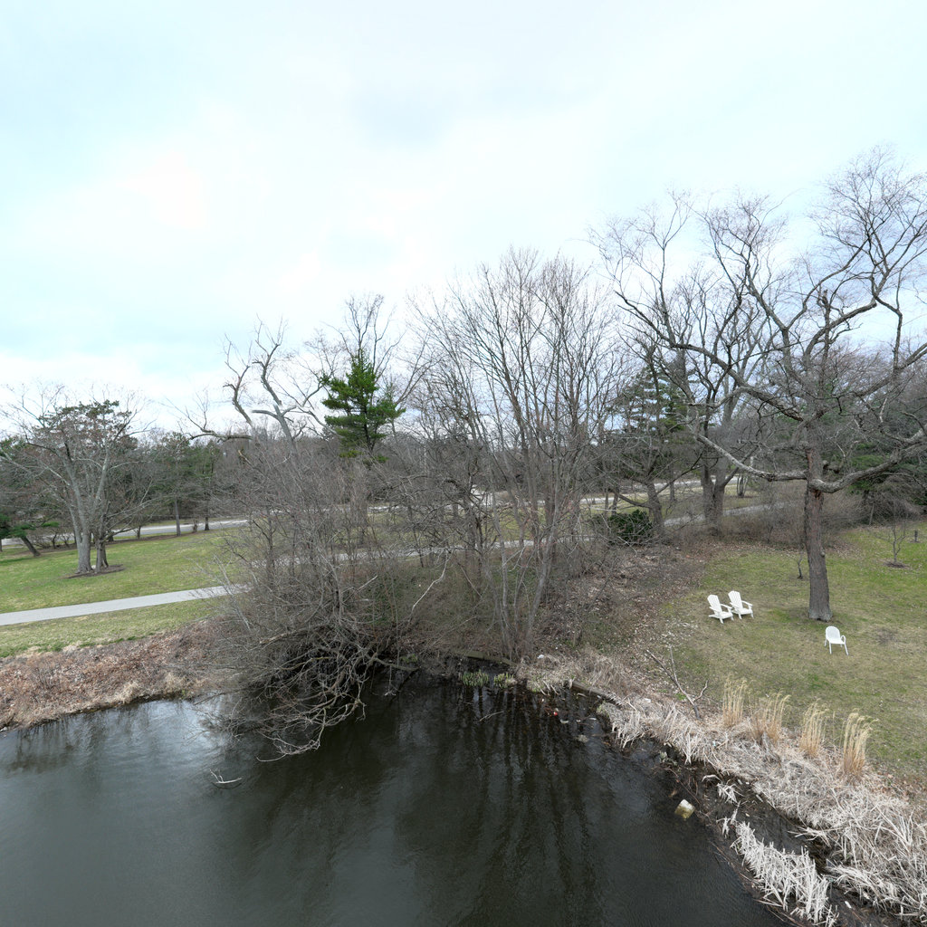
Summary: Front The front view shows a pond or small lake with residential properties along both banks. The left bank exhibits bare soil and sparse dormant vegetation with potential minor bank erosion, while maintained turf grass extends to the water's edge on the right side. White lawn chairs are visible on the right bank near a small island with dense shrub cover and exposed root systems. Right The right view displays a residential property with a large home, maintained lawn sloping gently to the water's edge, decorative pergola structures, and stone pathways. The bank shows evidence of landscaping with riprap protection near a small dock/landing area and minimal erosion due to established vegetation and structural controls. Back The back view shows the waterway extending in the opposite direction with residential properties on both sides, a wooden footbridge crossing the water, and maintained parkland. Banks exhibit dormant vegetation with minor erosion along waterlines, particularly on the right side where sparse grass cover leaves soil exposed near the water's edge. Left The left view reveals residential properties with maintained lawns, decorative features including a gazebo-like structure, and mixed vegetation along the shoreline. Banks show gentle slopes with established turf grass transitioning to dormant natural vegetation near the waterline, exhibiting minimal active erosion but some bare soil exposure along the immediate bank edge.
Scene #14
Erosion & Sediment Control Assessment
EXCELLENT
Front
ESE 110°
Right
SSW 200°
Back
WNW 290°
Left
NNE 20°

Up

Down
Summary: Front The forward view shows a gentle vegetated shoreline with established turf grass extending from water's edge to a paved trail. A white post marker is visible in the mid-ground with mature deciduous trees (dormant) throughout the park area. A small ornamental shrub or young tree stands prominently near the shoreline, with residential areas visible in the background beyond the park corridor. Right The right view reveals residential properties with large homes overlooking the water body. The shoreline features naturalized landscaping with mixed vegetation, ornamental plants, and established trees. A small peninsula or island with vegetation projects into the water, and dock structures are visible. The banks appear stable with dense vegetation coverage. Back The rear view looks back along the waterway showing residential development on both shores with mature tree canopy and park areas. The water body widens in this direction with vegetated peninsulas extending into the water. Both shorelines show established vegetation with no visible active erosion, and several residential docks are present. Left The left view shows a pedestrian bridge structure with red railings crossing the water, connecting park areas. The shoreline features maintained turf grass with a small riprap installation visible at the bridge abutment. A peninsula with mixed vegetation extends into the water, and residential development is visible in the background. The shoreline appears stable with good vegetation coverage.
Scene #15
Erosion & Sediment Control Assessment
EXCELLENT
Front
ESE 107°
Right
SSW 197°
Back
WNW 287°
Left
NNE 17°

Up
Down
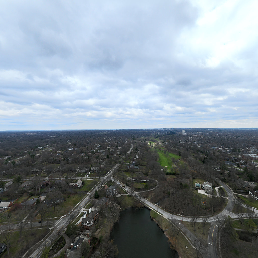
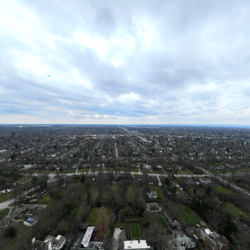
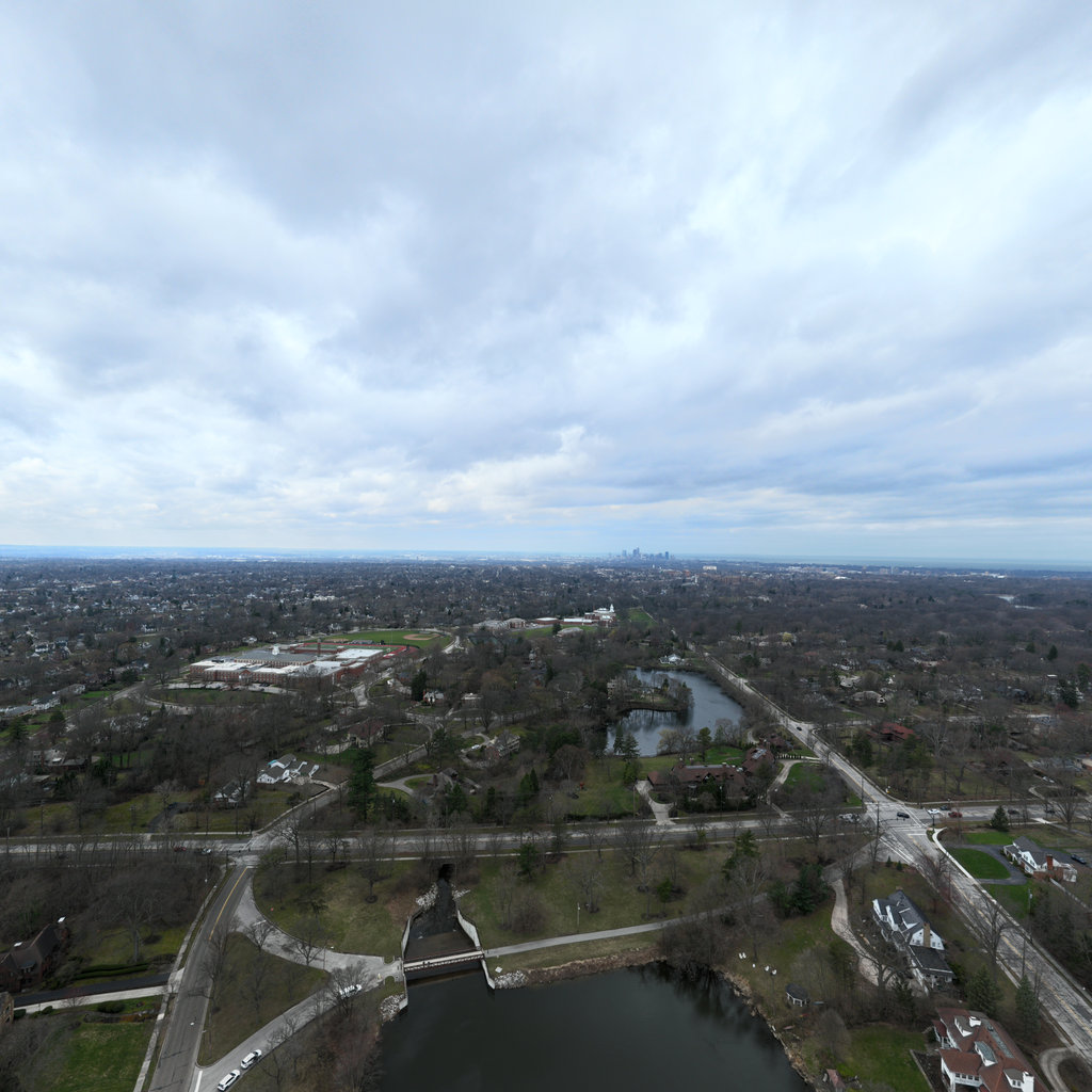
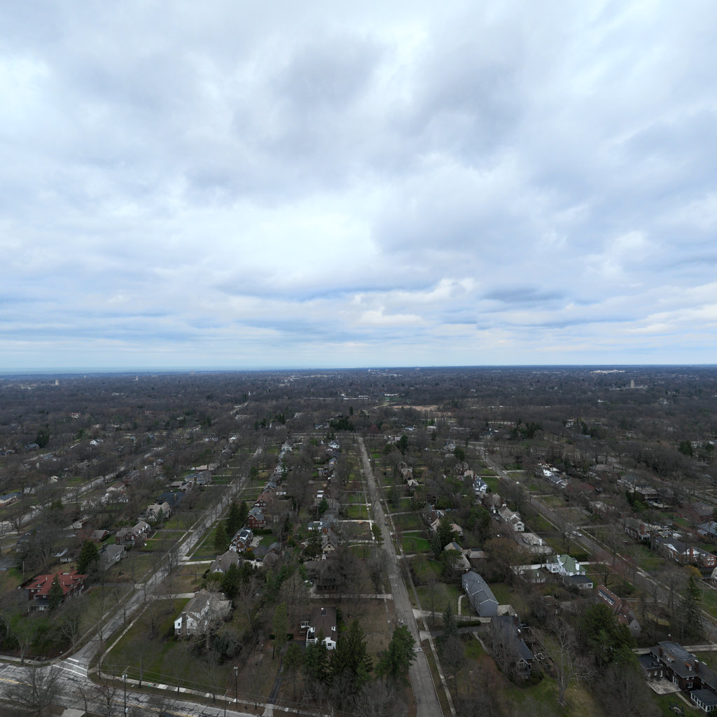
Summary: Front Aerial view showing urban residential development with streets, housing, and vegetated yards extending to the horizon. No ground-level erosion features are visible at this scale and distance. The landscape appears relatively flat with mixed vegetation cover across residential properties and street trees in dormant condition. Right Aerial view of residential neighborhoods with grid street pattern, houses with yards, and scattered tree cover in dormant condition. The landscape appears flat with established vegetation cover across properties. No erosion features are visible at this scale and viewing angle. Back Aerial view showing canal waterway with engineered bridges, residential development on both sides, and park/recreational areas with green spaces. The water channel appears managed with armored banks and structural controls. Urban infrastructure dominates with mature vegetation along corridors and in yards. Left Aerial view of residential neighborhoods with grid pattern streets, houses with yards, and scattered vegetation in dormant condition. The landscape is predominantly flat urban development with established tree cover along streets and properties. No erosion features are discernible at this viewing scale.
< Previous
Page 1 of 1
Next >