License Terrain360's archive of approximately 1.2 million 360° panoramas of trails, rivers, shorelines and public land, original imagery included, captured on foot, by bike and on the water in 38 US states plus Washington, DC, plus Canada and France, 2012 to 2026. Every image comes with a record of where and when it was captured, which way the camera faced, and how it connects to its neighbours along the route. None of it was shot from a car.
Or email ryan@terrain360.com · call 804.677.1456
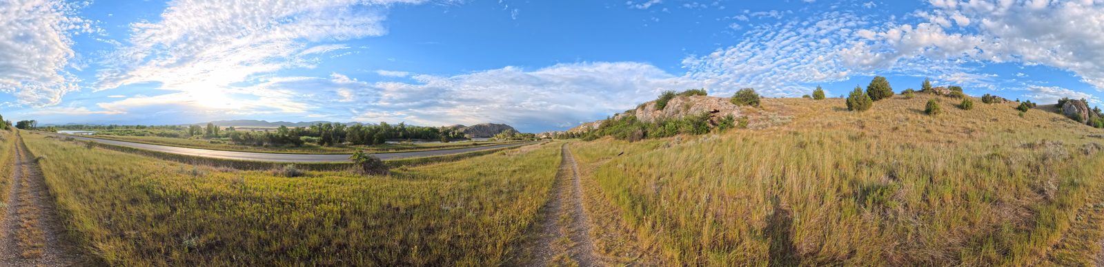
A niche, on purpose. This is not video, and it is not street-level imagery from a car. It is a still-image archive: full-sphere panoramas in ordered sequences, with position, heading and capture time on every scene, covering the part of the world the big collections mostly miss: trails, rivers, shorelines and public land, seen from eye level.
Captured on foot, by bike and on the water. Public off-road datasets run to thousands of labelled frames from a single site or campus; street-level collections follow roads.
Long river and shoreline runs captured by raft and boat: a view that is close to absent from public data.
Each scene links to the scenes before and after it, from about 2 metres apart on hiking trails to about 30 on open rivers and lakes, so a licensed set arrives as paths through a place, not loose photos.
Every scene is dated, 2012 to 2026, and 47 trails already carry a second pass from another year. A pass made before a storm or a restoration cannot be made later.
The images are the product. Each delivery pairs them with the records that make them usable, and a manifest that states exactly what was delivered.
The selected imagery in the source or prepared formats agreed for the delivery. Each file is identified as a camera original, a stitched original, a panorama reconstructed from archived cube faces, or a generated view.
One record per capture: identifiers, location, capture time, orientation, route relationships, image properties and the enrichments available for that scene.
One record per directional view (cube face): its parent scene, which way it faces, its geometry and file properties, and any analysis tied to that view.
Tracks, scene order, neighbouring-scene references and distances, and geographic context where available.
Available captions, placed object candidates, text readings and other agreed outputs, each with its method, provenance and measured coverage.
Exact scene and file membership, formats, checksums, field availability, provenance and the purchased use.
Metadata comes as JSON, JSONL or CSV. GeoJSON is available as an additional geographic view of the same records. A panorama and its six cube faces are views of one capture and are never counted as separate captures. Camera originals, analysis layers, refreshes and special preparation are named in the agreed delivery scope.
Explore the recorded May captures from sections of the Appalachian Trail collection. See the place, year, viewing direction and metadata of each image, then build a collection around your project.
The month filter reads each scene's own capture date, not the collection's date range. It does not imply full trail coverage, captures in every May, typical seasonal conditions or repeat captures at every point.
Loading the capture index…
| Field or layer | Kind | Scenes | Coverage |
|---|
Want this for your geography, season or use? Tell us the places and the use, and we will cut a selection from the archive, with its field coverage, before you commit.
Terrain360 pairs its imagery with structured metadata covering location, orientation, capture history, route continuity, image geometry, environmental context and provenance.
Geographic and sequence records include latitude, longitude, elevation, geohashes, camera heading, direction of travel, adjacent-scene IDs and distances, and linked route tracks. Capture records preserve the recorded camera clock and, where it can be established, the time zone and clock source, with season and time of day.
Image records describe the camera and source imagery, pixel dimensions, projection, horizontal and vertical field of view, crop geometry, file size and checksums. Environmental enrichments include protected-area designations and managers, ecoregions, and historical weather estimates associated with the capture location and time. Sensor fields are available for the capture generations that recorded them.
Additional analysis layers include scene descriptions, placed object candidates with confidence scores, text readings and, for agreed releases, embeddings and segmentation. They help find and select scenes by visible content, terrain and environmental character.
Together these layers let a buyer assemble a targeted collection, keep spatial and temporal relationships, join the imagery to GIS data and trace each delivered file back to its source. Field coverage, derivation methods and missing values are documented in the delivery manifest. Available layers and their permitted uses are specified for each delivery.
Each licensed scene is read across all six faces of the sphere. Fields are model-generated candidates with confidence, until a person reviews them. The explorer's coverage table shows how much of a selection already carries each layer today.
"objects": [
  { "type": "sign", "label": "No Parking sign",
    "view_id": "1537486-f", "anchor": { "x": 0.86, "y": 0.64 },
    "bearing_deg": 258.9, "confidence": 0.8,
    "placement_quality": "reliable",
    "attributes": { "text": "NO PARKING BEYOND THIS POINT" },
    "status": "model-generated candidate" },
  { "type": "structure",
    "label": "kayak rental trailer with stacked kayaks",
    "view_id": "1537486-l", "anchor": { "x": 0.2, "y": 0.53 },
    "bearing_deg": 102.1, "confidence": 0.9,
    "estimated_distance_m": 15,
    "status": "model-generated candidate" }
]
Haulover Canal kayak launch, Florida, captured 8 August 2026. Open it in the explorer to see both pinned on their views.
| Group | Example fields | Kind |
|---|---|---|
| Location and identity | scene_id, trail_id, trail_name, latitude_deg, longitude_deg, elevation_m, geohash_6, geohash_9, state | Recorded |
| Orientation and sequence | pano_heading_deg, pano_heading_method, pano_heading_confidence, travel_bearing_deg, previous_scene_id, previous_scene_distance_m, next_scene_id, next_scene_distance_m, track_file | Recorded and derived |
| Capture history | capture_time_local, capture_time_utc, time_zone, camera_clock_local, time_source, time_note, season, month, time_of_day_local | Recorded; time zone only where it can be established |
| Image geometry and provenance | image.source, image.width_px, image.height_px, image.projection, image.horizontal_fov_deg, image.vertical_fov_deg, image.crop_top_px, image.zenith_captured, image.nadir_captured, image.bytes, image.sha256, camera.model | Measured from the delivered file |
| Environmental enrichment | ecoregion levels 1 to 3 with basis; protected-area unit, manager, designation, access, match distance and source; historical weather source, basis, hour, temperature, humidity, precipitation and wind | Geographic join or modelled estimate |
| Applicable sensors | sensor.speed_kmh, sensor.course_deg, sensor.gps_fix, sensor.light_lux | Recorded, where the capture generation logged them |
| Available scene analysis | scene_analysis.caption, water_kind, surface, people_in_view, method; placed objects with face, position, bearing, confidence; text readings with legibility | Model-generated unless marked human-reviewed |
| Delivery and completeness | pack_id, file_stem, image.file, track_file, notes, missing | Written at delivery |
These groups come from a 30-scene evaluation index. Not every field is populated for every scene: older capture generations carry fewer sensor fields, and analysis layers exist only where they have been produced. Embeddings and segmentation are separate layers with their own schemas, delivered when a release includes them. The explorer above shows the measured coverage of real selections.
No sign-up. Each pack is a zip of complete scene packages from one capture: camera originals, the stitched panorama, the tile set, the records and the analysis. Download links are created when you click and stay valid for one hour.
July 2026Insta360 X5On land15 scenes1.07 GB
15 scenes sampled evenly from a continuous 179-scene capture of the Agate Fossil Beds trails.
Previews from this capture. Select one to enlarge.
July 2021Multi-camera rig: five Canon EOS Rebel T2i bodiesOn the water15 scenes321 MB
15 scenes spaced evenly across a continuous 1,488-scene, 13.5-mile capture from a raft on the Missouri River through the White Cliffs in the early morning, chosen from scenes with no people in view.
Previews from this capture. Select one to enlarge.
2012 to 2026Several rigs, 2012 to 2026On land and on the water30 scenes472 MB
30 scenes from 29 places across the corpus: 14 on land and 16 on the water, in 17 states, captured 2012 to 2026 on several camera rigs. Items 29 and 30 are the same spot on the James River, in July 2014 and September 2020. A breadth sample: each scene ships as the full-resolution panorama, record, analysis and track; samples 1 and 2 show the complete per-scene package.
Previews from this capture. Select one to enlarge.
Full-resolution 11,968 by 5,984 panoramas, one per trail, each with its JSON record. Browse and download any one.
Records and cube-face links for 50 scenes across seven captures, straight from the API. No key needed.
The explorer's scene and view records, with measured files and checksums, for any public scene.
Eight of the 57 ecoregions the archive covers, each a forward view from one scene. Select one to enlarge.
Fairyland Canyon, Bryce Canyon, UtahDesert canyon
Lake McDonald, Glacier, MontanaMountain lake, on the water
Loxahatchee Wildlife Refuge, FloridaNorthern Everglades wetland, on the water
California Coastal Trail, CaliforniaPacific coast bluffs
Fort to Sea Trail, OregonTemperate rainforest
Lolo Trail, IdahoNorthern Rockies forest
South Branch Potomac River, West VirginiaAppalachian river, on the water
West Branch Susquehanna, PennsylvaniaNorthern forest river, on the water
The same scene package serves many kinds of work. Each use rests on fields the records actually carry; model performance gains are not promised.
Real, posed viewpoints through natural terrain and along water. From a full-sphere original, any camera direction can be rendered along a real track.
Built on: Stitched originals, panorama heading, scene order and spacing.
Ground-level views at known positions off the road network, for localization, place recognition and ground-to-aerial matching.
Built on: Recorded positions, headings, geohashes and view geometry.
Small held-out packs with answers that can be checked: where is this, which way is upstream, what is ahead.
Built on: Route, place and date groupings, so near-identical neighbours stay out of each other's splits.
Terrain, surface and trail perception for wheeled and legged robots, where public off-road datasets are small.
Built on: Travel direction, neighbouring-scene distances, surface fields.
Shoreline, obstacle and on-water perception for surface vessels, from long runs captured by boat.
Built on: On-water sequences, heading, protected-area and gazetteer joins.
Dense outdoor sequences for large-scale reconstruction, Gaussian splatting and novel-view tests.
Built on: Camera originals, cube faces with their geometry, scene spacing.
Dated passes as before-and-after baselines for storms, floods, erosion and restoration.
Built on: Capture dates at matched locations; 47 trails already have a second pass.
Signs, docks, ramps, paths and shoreline features, with previews of places off the road map.
Built on: Placed object candidates and text readings, tied to the view and the map.
The data type is not new. Map and technology companies have collected ground-level imagery for years, and use it for navigation, mapping, visual positioning, 3D reconstruction and model training. Nearly all of it is collected from roads.
Over 280 billion images from 360 cameras on cars, and since 2012 a backpack Trekker on trails and on boats.
Google says: "We use Street View imagery to train and prompt our powerful generative AI models (like Gemini, Nano Banana, and Veo)."
Survey vehicles, plus pedestrian surveys with a backpack system.
Apple says it uses survey imagery "to train models powering Apple products and services, including models related to image recognition, creation, and enhancement."
More than two billion street-level images.
Its terms let commercial users apply the imagery to the "training, and development of products, services, maps". Its Vistas and Metropolis sets were built to train and test computer vision.
A geospatial model built on over 30 billion posed images, scanned by phone.
Niantic says the data "is taken from a pedestrian perspective and includes places inaccessible to cars."
360 street-level imagery from survey vehicles.
Cyclomedia sells its 360 street imagery with LiDAR and analytics; HERE uses its panoramic camera cars to build maps and navigation.
Licensing real-world street imagery.
In September 2026 GrabMaps licensed its Southeast Asian street imagery for the development of "world models, geospatial systems, robotics", for training and evaluation.
The gap is off the road. Google keeps Street View's training rights for itself: its Maps Platform terms bar customers from using the content to "train, test, validate or fine-tune" models. Google has also taken cameras up trails and down rivers, which shows what those places are worth. This archive is 13,400+ miles of them.
Browse the archive's 469 collections by state, river, trail or park, draw your own area, or ask for a kind of place: every hiking trail in the Northeast, say, or the Florida shoreline walked on the beach. We deliver what the archive holds and capture the rest to the same standard, under the same terms.
Select by region, ecoregion, water or land, season, year, elevation or protected land. Every scene carries a map-cell code, so an area comes out cleanly.
New corridors on foot, by bike or on the water, delivered as the same per-scene package. We capture every season, so new work goes into the next field trip.
47 trails already have a second pass from a later year. Return to any corridor on a schedule to record change: across seasons, across years, or after a storm or construction.
Every option is quoted to the scenes, layers, formats and use you need. Text on this site stays free to use with attribution.
| Option | What you get | How it is sold | Price |
|---|---|---|---|
| Samples | The packs and records above. | Open to everyone: no sign-up, no key, no payment. | Free |
| Evaluation pack | About 1,000 scenes from corridors you choose. | Request, invoice, delivery within five business days of payment. | Quote |
| Corridor and area packs | Whole trails, rivers, regions or a drawn area, with optional month and year filters. | Per scene. Invoice, or purchase order for public agencies. | Quote |
| Full archive | Every licensable scene, perpetual for the delivered set, with scheduled releases of new capture. Exclusive terms on request. | Quote and signed agreement. | Quote |
| Prepared packs | Ready-made releases, such as eight Angels Landing scenes with 48 cube faces and a searchable index. | Review the license and pay by card. See the pack. | Quote |
| Sentinel detections | Timestamped, geolocated species detections from Sentinel field cameras. | By agreement with the site owner and Terrain360. | Quote |
| Commissioned capture | A corridor that is not in the archive yet, captured to the same standard and delivered under the same terms. | Scoped by corridor. See custom maps. | Quote |
Quotes are in US dollars and exclude taxes. Corridor and full-archive licenses exclude scenes captured under agreements that reserve rights to a client or agency; those corridors are named in the quote. Volume and multi-year terms are available.
Download the packs, open any scene's record in the explorer, or pull the JSON sample. Nothing to sign.
Book a call or email the places, dates and use. Or build a selection in the collections browser and send it as a quote request; it keeps any month and year filter you set.
An itemised quote within one business day. After payment: a signed manifest for every file in your own bucket, within five business days. The license is perpetual for the delivered set.
Training, fine-tuning, evaluating and benchmarking models, including generative and world models. Internal research, simulation, mapping and analysis. Shipping models and products built from the data; the weights are yours. Publishing results and small excerpts with attribution.
Redistributing, reselling or re-hosting the panoramas or records themselves. Building a street-level imagery viewer or a competing archive from the delivered set. Identifying individuals, vehicles or private property. Removing the license record that ships with the set.
Trail descriptions, hotspot narratives and place metadata may be used for search, grounding and training without charge. Cite Terrain360 (terrain360.com) and link the trail page. Imagery and per-scene data are licensed.
Data license terms Machine-readable terms (RSL 1.0) llms.txt /api/llm/corpus
Ryan Abrahamsen runs data licensing at Terrain360. Book 30 minutes to talk through your geography, dates and use, or send a note and get a reply within one business day.