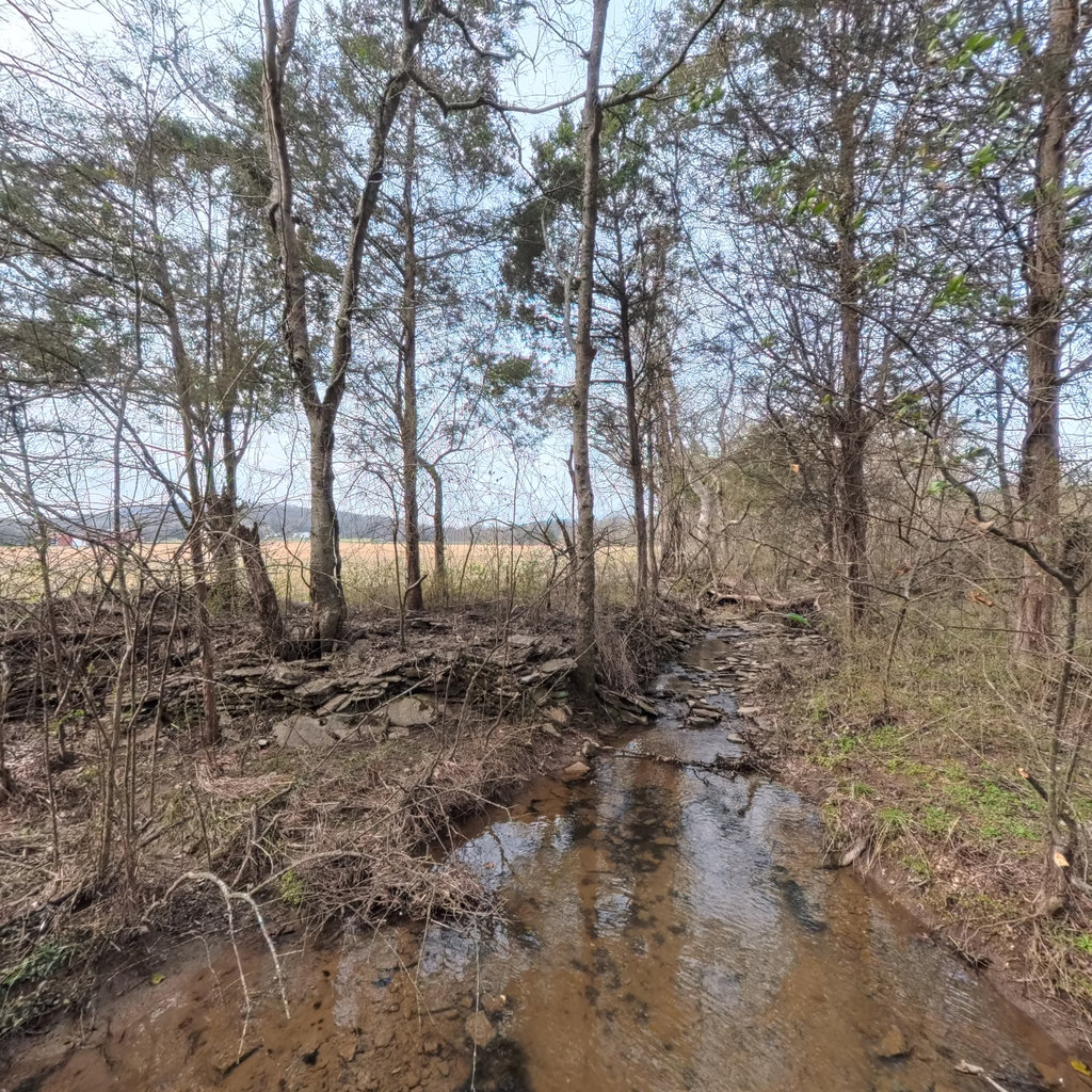
Front
W 262°
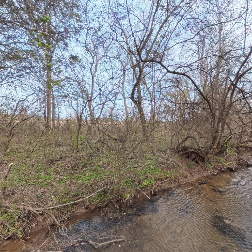
Right
N 352°
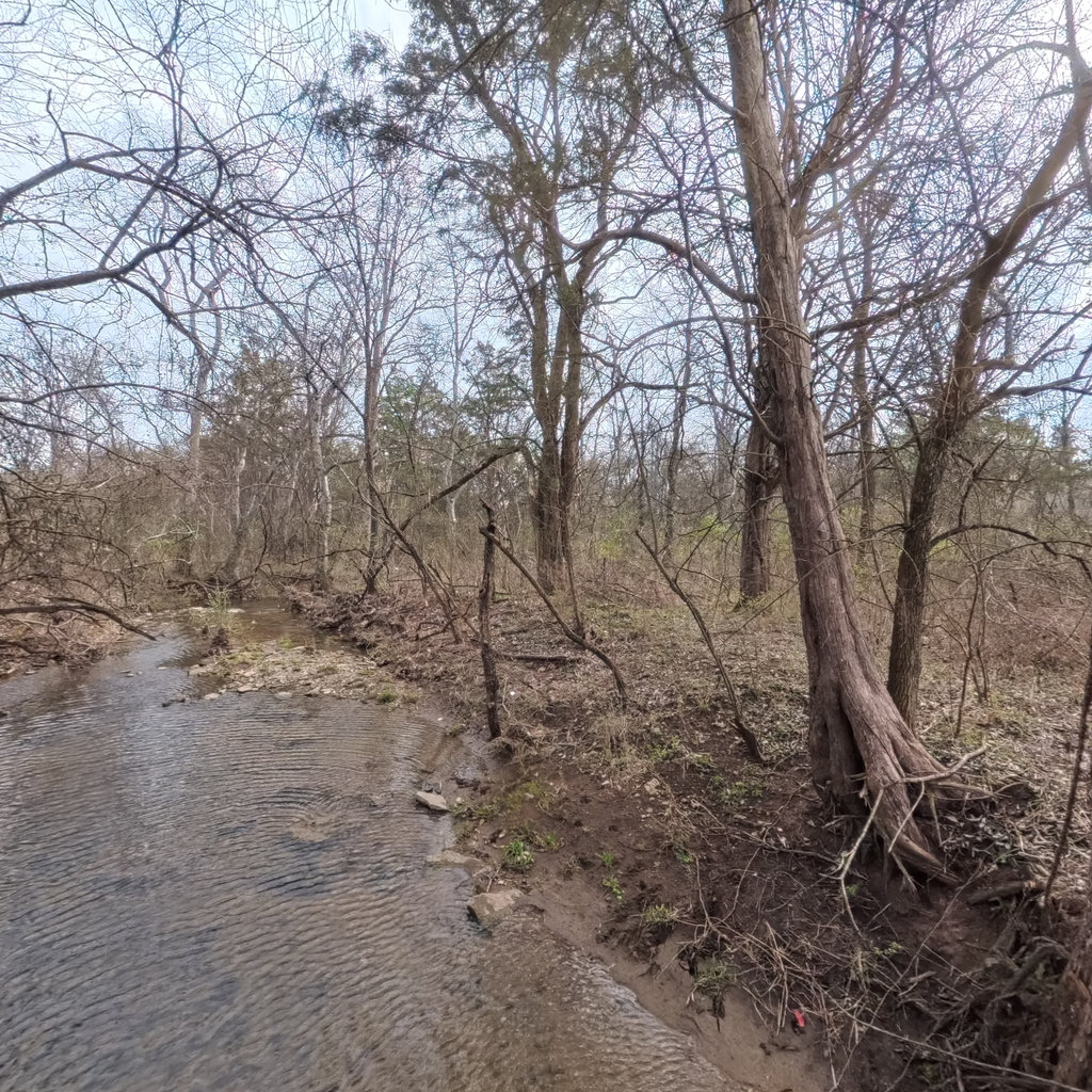
Back
E 82°
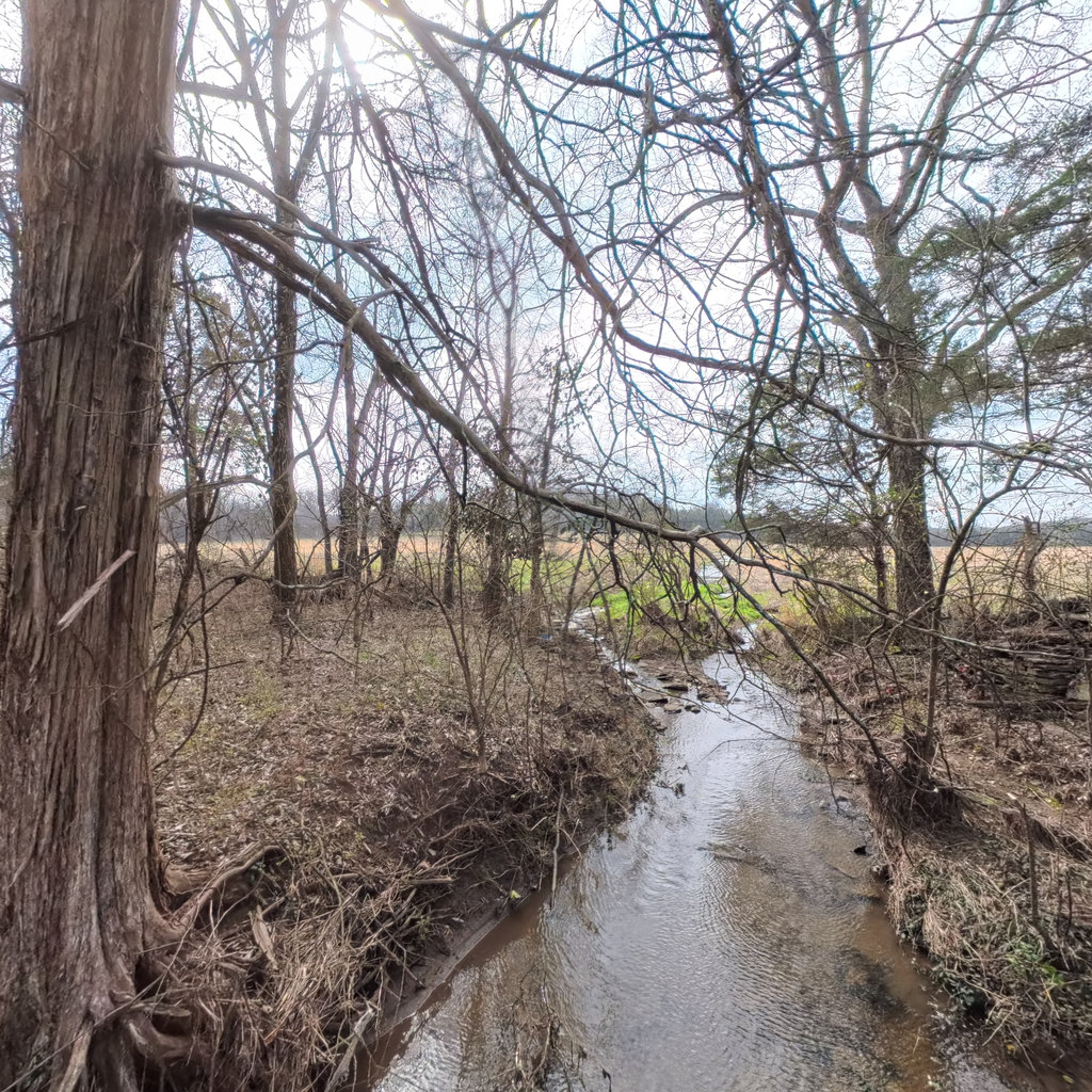
Left
S 172°
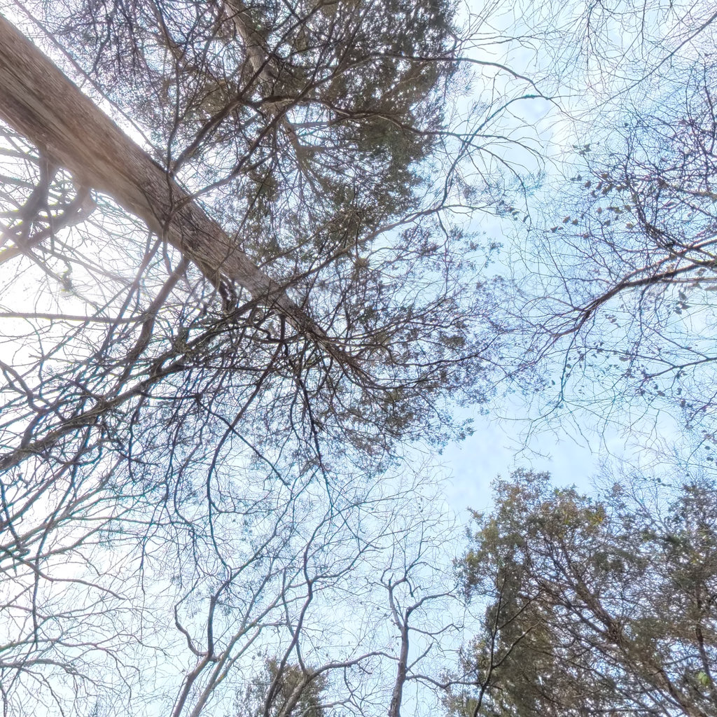
Up
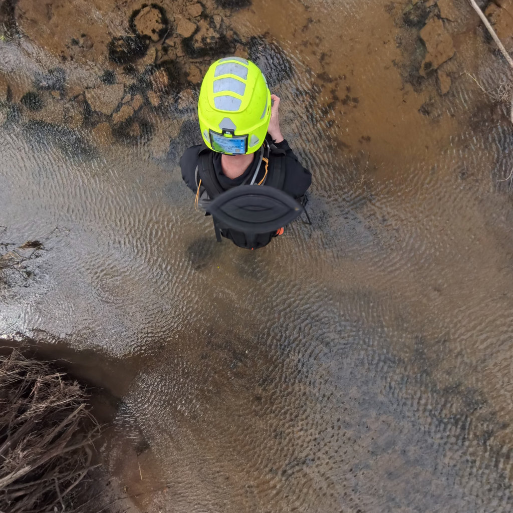
Down
Summary: Front Looking downstream, the channel narrows and flows through a wooded corridor with predominantly bare deciduous trees. Exposed flat rock slabs are visible on the left bank forming a shelf-like ledge above the water. The channel appears to have a slight curve to the right. Agricultural fields are visible through the trees in the background on the left side. Right The right bank (left bank when facing downstream) shows a low to moderate bank with deciduous trees and shrubs in dormant condition. Green herbaceous ground cover is emerging on the bank. The bank shows exposed soil and some root exposure where trees meet the water's edge. Agricultural fields or open land with structures are visible in the background through the bare canopy. Back Looking upstream, the channel curves away to the left with flowing water visible. The right bank shows exposed soil with tree roots and cedar trees. A wooded riparian corridor is present on both sides but the buffer appears narrow, especially on the left side where open land is nearby. Some woody debris is in the channel near the banks. Left The left bank view (right bank when facing downstream) shows a narrow wooded riparian corridor with large cedar and deciduous trees. Beyond the riparian strip, open agricultural fields are clearly visible. The stream curves downstream with shallow water flowing over what appears to be flat rock substrate. The riparian buffer is thin, perhaps only 25-50 feet before transitioning to open agricultural land. Some flat rock visible at the far right edge of the view in the channel.

Front
W 262°

Right
N 352°

Back
E 82°

Left
S 172°

Up

Down
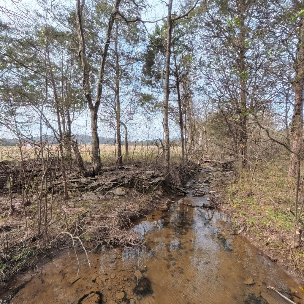
Summary: Front Looking downstream, a small headwater stream flows through a narrow wooded corridor with exposed bedrock/limestone substrate visible in the channel. Beyond the thin riparian buffer, open agricultural fields are visible in the background with what appears to be a red barn or structure on the far left. The stream channel is shallow with scattered flat rock in and along the bed. Right The right bank (left bank when facing downstream) shows a low bank with herbaceous ground cover and bare deciduous trees. The bank rises gently with a mix of grass, scattered shrubs, and dormant deciduous trees. Beyond the thin riparian strip, what appears to be agricultural land or open fields is faintly visible through the trees. Some bank erosion is evident with exposed soil near the waterline. Back Looking upstream, the stream channel extends with shallow water flowing over a mixed substrate. The left bank (right when facing upstream) has exposed soil and roots with some erosion evident. Eastern red cedar and other deciduous trees line both banks with exposed root systems visible at the waterline. The channel appears slightly incised with moderate bank heights. Left The left bank (right bank when facing downstream) shows a narrow stream channel with a large eastern red cedar tree at the bank edge and various dormant deciduous trees. Agricultural fields are visible beyond the thin riparian buffer on this side. The bank shows some root exposure and minor erosion. The stream is narrow, maybe 4-6 feet wide at this point, with low banks and a thin riparian corridor separating the channel from open fields.
Front
WSW 258°

Right
NNW 348°

Back
ENE 78°

Left
SSE 168°

Up

Down
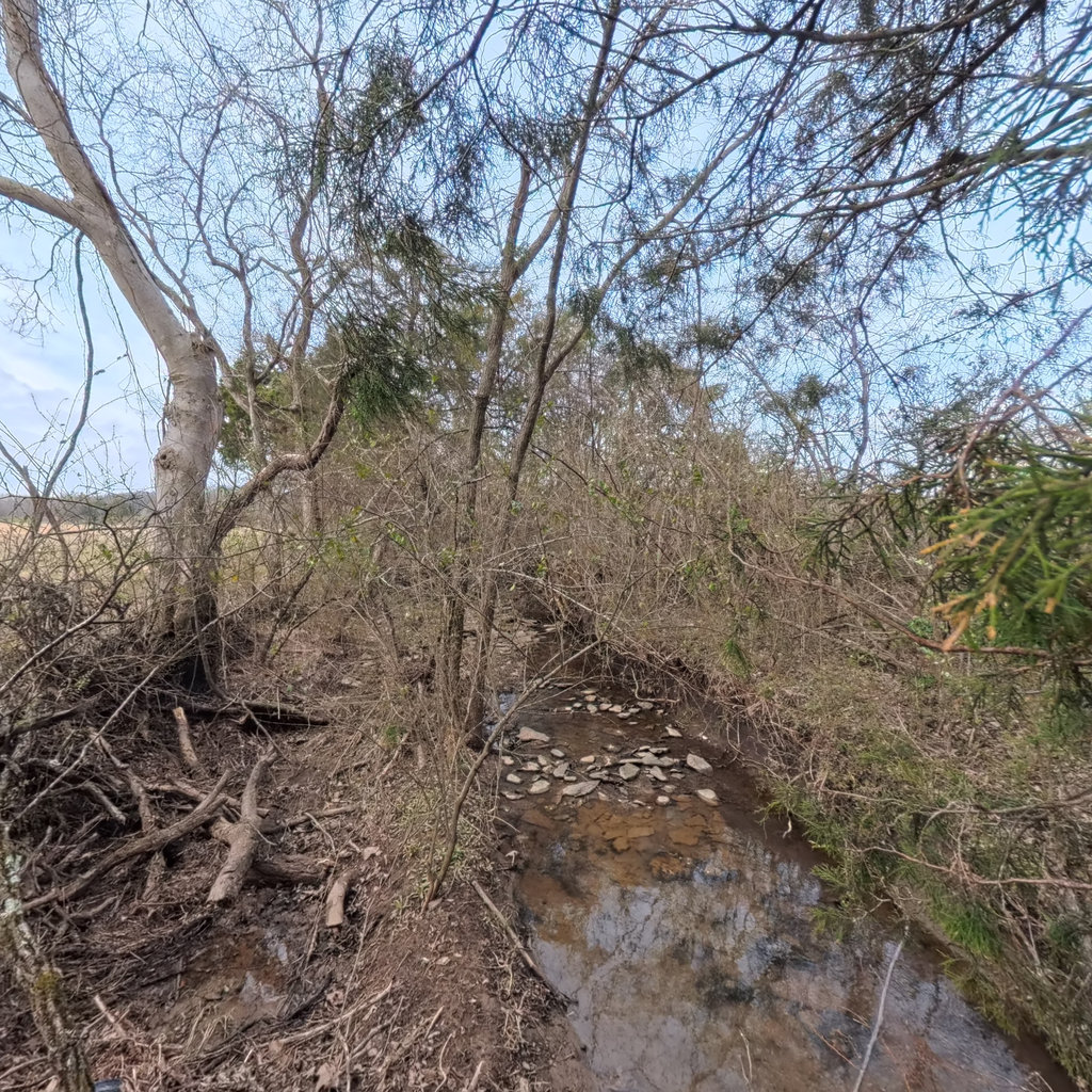
Summary: Front Looking downstream, the channel narrows and bends slightly to the left through a thin riparian corridor of bare deciduous trees and eastern red cedars. A flat rock/limestone ledge outcrop is visible on the left bank forming a natural step or riffle feature. Beyond the thin tree line, open agricultural fields are visible in the background with a distant red structure (barn). The channel bed shows shallow water flowing over flat rock substrate. Right The right bank (left bank when facing downstream) shows a moderately vegetated riparian area with bare deciduous trees, scattered shrubs, and some green herbaceous ground cover. The bank is low to moderate height with exposed root systems and minor bank erosion. The water surface is gently flowing and slightly rippled. Beyond the immediate riparian zone, hints of open land or cleared areas are visible through the bare canopy. Back Looking upstream, the channel extends with gentle flowing water through a wooded riparian corridor. The left bank shows bare deciduous trees and shrubs with exposed root wads at the bank edge. Some fallen and leaning woody debris is visible in and near the channel. The riparian corridor appears narrow with hints of open agricultural land visible beyond. The channel bed appears to be a mix of silt, mud, and some flat rock. Eastern red cedars are visible on the right bank. Left The left bank view (right bank when facing downstream) shows eastern red cedars (Juniperus virginiana) as prominent bank trees with exposed root systems. The channel flows downstream with shallow, gently moving water. Open agricultural fields are clearly visible beyond the thin riparian buffer, indicating the buffer is very narrow on this side—likely only 10-25 feet wide. Some fencing may be present at the field edge. The bank has bare soil exposure and minor erosion.

Front
W 268°

Right
N 358°

Back
E 88°

Left
S 178°

Up

Down
Summary: Front Looking downstream, the channel is a very narrow, shallow stream with exposed flat rock substrate and scattered loose cobble/gravel. Water flows in a thin film over bedrock. Deciduous trees are bare on both banks, with open agricultural fields visible through the tree line to the left. A fallen log/debris jam partially spans the channel ahead. Right The right bank (left bank when facing downstream) shows a wooded riparian area with bare deciduous trees and a mix of green herbaceous ground cover emerging in early spring. Beyond the tree line, open agricultural/pasture fields are visible. The riparian buffer extends approximately 25-50 feet before transitioning to open land. A possible old structure or large debris is visible in the mid-ground. Back Looking upstream, the channel widens slightly and the water is somewhat deeper with a visible flowing surface over a sand/gravel/bedrock substrate. Trees with exposed root systems line the banks, especially on the right (left bank facing downstream) where significant root exposure and minor bank erosion is evident. Bare deciduous trees dominate with a few evergreens (cedars) visible. A fence line or wire is visible crossing the upper portion of the scene. Left The left bank (right bank when facing downstream) shows a steep, rocky bank with exposed flat limestone rock and scattered trees growing from the bank face. Beyond the narrow riparian strip, open agricultural/pasture land is visible with a red barn structure in the distance. The rock on the bank appears to be natural limestone layers consistent with local geology, though some flat pieces have somewhat angular edges. Hills/ridgeline visible in the far background.
Front
NW 310°

Right
NE 40°

Back
SE 130°

Left
SW 220°

Up

Down
Summary: Front Looking downstream, a very small stream channel is visible with shallow water flowing over a limestone/flat rock substrate. The channel is narrow (approximately 3-5 feet wide) and flanked by dense dormant vegetation including cedars (eastern red cedar) and deciduous trees. Flat tabular rocks are exposed as mid-channel bars and bed substrate. Right Looking toward the right bank (when facing downstream), dense dormant vegetation is visible including eastern red cedar trees and tangled deciduous shrubs and vines. The bank rises moderately from the channel with a mix of grass and dormant herbaceous cover. The vegetation is thick but largely bare of leaves, suggesting winter dormancy. Some cedars retain green foliage. Back Looking upstream, the narrow stream channel stretches away with a rocky limestone bed clearly exposed. Water is very shallow, flowing in a thin ribbon over flat rock substrate. The channel is flanked by cedars and deciduous trees on both sides, with an open agricultural field visible through the trees on the right (which corresponds to the left bank when facing downstream). The rocky bed shows natural layered limestone with some larger cobble/flat rock pieces. Left Looking toward the left bank (when facing downstream), an expansive open agricultural field (pasture/hay) is visible beyond a narrow strip of riparian trees. A red barn and farm structures are visible in the distance approximately 500+ feet from the stream. The bank itself is moderately high with exposed roots and rock. The riparian buffer on this side appears thin, with the agricultural field encroaching relatively close to the channel. A fluorescent green hard hat or safety equipment is visible at the bottom of frame, confirming backpack-pole survey method.

Front
W 279°

Right
N 9°

Back
E 99°

Left
S 189°

Up

Down
Summary: Front Looking downstream through dense shrubby vegetation along a very small stream channel. Flat limestone-like rock fragments visible in the channel bed forming a rocky substrate. Agricultural fields and a red barn/structure visible in the background through the bare branches on the left side. The channel appears narrow and shallow with minimal water flow. Right Dense thicket of shrubs and small trees covering the right bank, with very little visibility through the vegetation. The bank rises moderately with dense herbaceous ground cover and dormant shrubby growth. Early spring green-up just beginning with scattered small green leaves emerging. The density of the shrub layer suggests possible invasive species such as bush honeysuckle or multiflora rose. Back Looking upstream, a very small stream channel is visible with shallow brown-tinted water flowing over a rocky and muddy substrate. The left bank shows dense shrubs and small trees. A larger fallen log spans partially across the channel creating a minor debris jam. The right bank is vegetated with trees and shrubs, some showing early spring leaf emergence. An evergreen tree (likely cedar) is visible in the upper right. Left Looking at the left bank, mature deciduous trees with bare branches frame the view. Beyond the immediate riparian corridor, open agricultural fields are clearly visible extending to the horizon with a red structure (barn) visible in the far distance. The bank area shows some woody debris and sparse ground cover. A small area of standing water or very shallow pool is visible at the base of the bank near the channel.
Front
W 278°

Right
N 8°

Back
E 98°

Left
S 188°

Up

Down
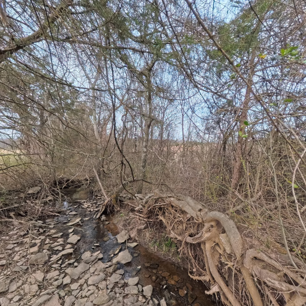
Summary: Front Looking downstream, a very narrow thread of low flow water winds through a bed dominated by flat, angular limestone/shale substrate. Exposed tree roots from a large fallen or leaning tree are prominent on the right side of the channel. Dense dormant deciduous shrubs and small trees line both banks with early spring leaf-out beginning. A building or structure is faintly visible in the far left background through the vegetation. Right Looking toward the right bank (when facing downstream), dense dormant deciduous shrubs and small trees form a thick riparian thicket. Early spring green leaves are emerging on some shrubs, possibly bush honeysuckle or privet based on early leaf-out timing. The bank edge shows exposed roots, woody debris, and some flat rock fragments. Visibility into the landscape beyond is limited by the dense vegetation. Back Looking upstream, the narrow channel continues with very low flow over flat limestone/shale substrate. The bed is largely exposed with angular rock fragments. Dense dormant shrubs line both sides. A branch partially obstructs the camera view. Through gaps in vegetation on the right side, open pasture/agricultural land and distant structures are visible, indicating the stream corridor is bordered by agricultural land use. The bank on the right shows some bare soil exposure. Left Looking toward the left bank (when facing downstream), trees and sparse shrubs reveal open agricultural pasture beyond with a distant red barn/farm structure visible. The riparian buffer on this side is narrow — only a thin line of trees separates the stream from the open pasture. The bank shows exposed rock and soil. Some small deciduous trees are present but the buffer appears to be only 10-25 feet wide before transitioning to open grassland.

Front
W 271°

Right
N 1°

Back
E 91°

Left
S 181°

Up

Down
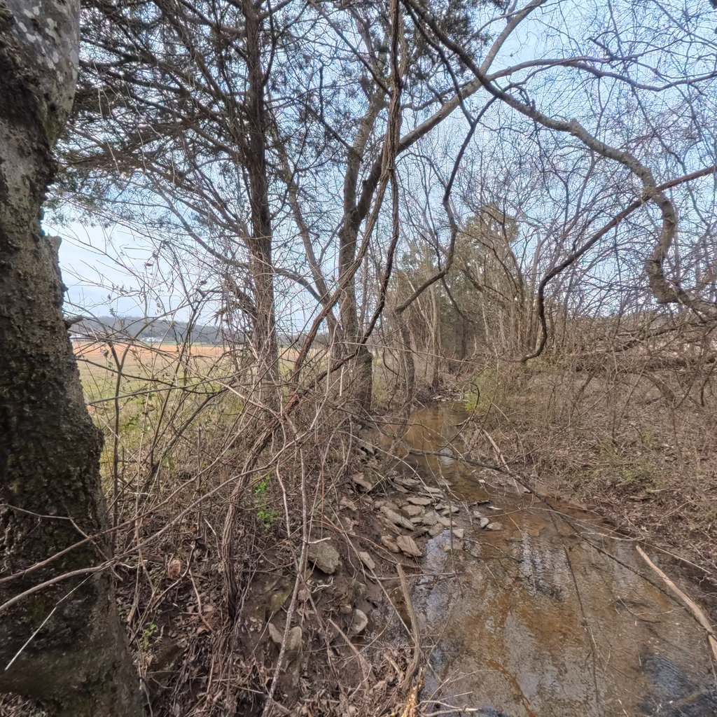
Summary: Front Looking downstream, a narrow stream channel is visible with very low flow winding through exposed flat rock substrate. The left bank shows agricultural fields beyond a thin riparian corridor. Trees are leafless with some Eastern red cedars providing evergreen cover. Flat, angular rock pieces line the bank and channel bed. Right The right bank (left bank when facing downstream) shows a steep, densely vegetated slope with bare deciduous trees and thick understory brush. Flat limestone rock pieces are visible at the base of the bank where it meets the channel. The slope rises moderately with dense tangled vegetation including vines and shrubs. Back Looking upstream, the channel continues as a narrow, shallow stream with very low flow over exposed limestone bedrock and cobble substrate. A large fallen tree with extensively exposed root mass spans near the channel, indicating significant bank erosion and undercutting. Dense riparian vegetation lines both banks with bare deciduous trees and some cedars. Left The left bank (right bank when facing downstream) shows trees at the bank edge with an open agricultural field visible beyond. The riparian buffer is very narrow, perhaps only 10-30 feet wide with scattered trees and shrubs before giving way to open cropland. Flat limestone rock pieces are visible along the bank toe. A red structure or vehicle is visible in the distant agricultural landscape.
Front
W 264°

Right
N 354°

Back
E 84°

Left
S 174°

Up

Down
Summary: Front Looking downstream along a narrow, shallow creek channel bordered by bare deciduous trees and dense shrubby undergrowth. The channel has flat rock/slab substrate visible along the left bank edge with shallow water flowing over a mud/silt bed. Agricultural fields are visible in the background through the bare trees on the left side. Right Dense thicket of bare deciduous shrubs and small trees forming the right bank riparian zone. The vegetation is dormant but provides dense structural cover. Behind the riparian strip, agricultural pasture/field land is faintly visible through the vegetation. No water or channel features are directly visible in this direction. Back Looking upstream, the view shows dense riparian vegetation including what appears to be eastern red cedar (evergreen) and bare deciduous trees forming a tight canopy. Below, the narrow channel is partially visible with flat rock slabs along the bank edge and shallow water. The dense cedar/evergreen vegetation provides year-round cover on this bank. Left Looking toward the left bank (facing downstream), the view opens to a broad, flat agricultural field/pasture. A narrow strip of riparian trees and shrubs borders the stream, with open grassland extending several hundred feet to a distant red agricultural building/barn. The riparian buffer on this side appears quite narrow, transitioning quickly to mowed or grazed pasture.

Front
W 262°

Right
N 352°

Back
E 82°

Left
S 172°

Up

Down
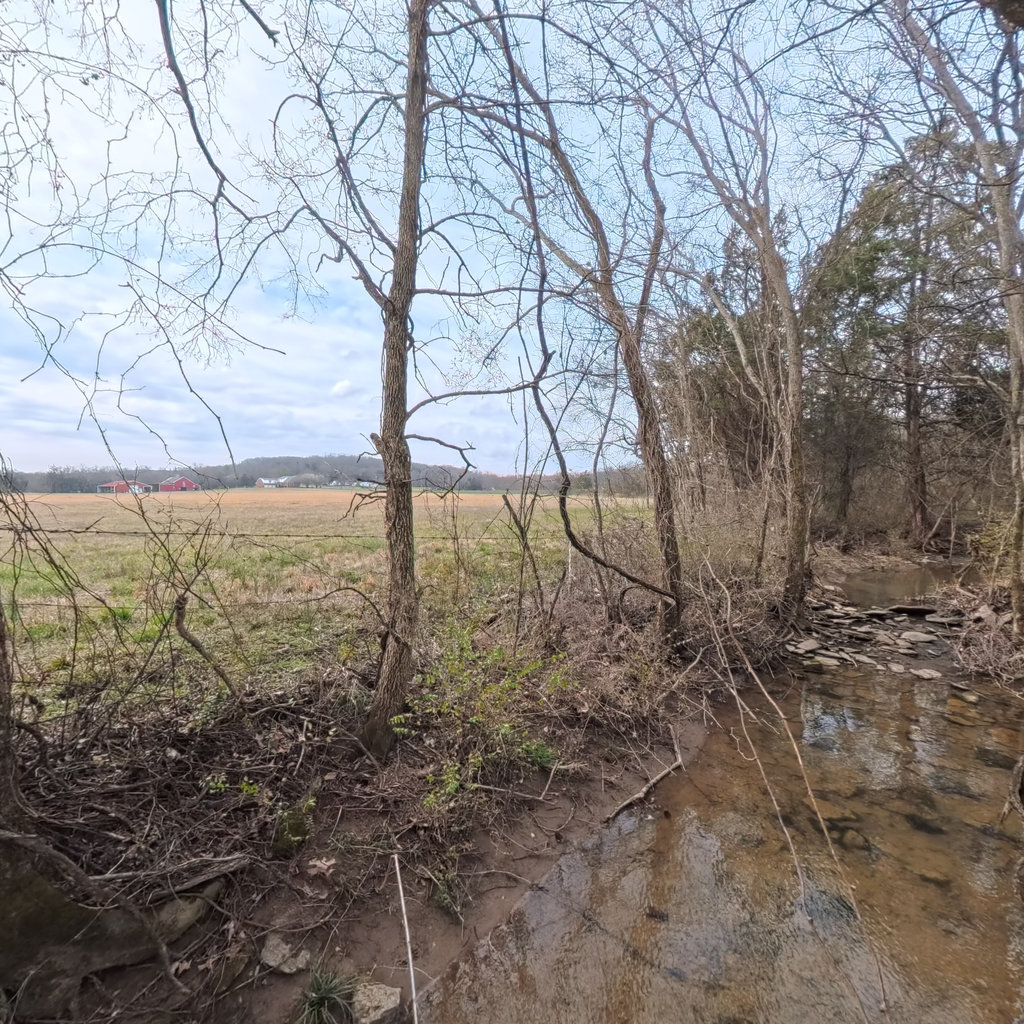
Summary: Front Looking downstream, the view shows dense deciduous trees and shrubs, all bare of leaves in winter condition. The ground is covered with leaf litter and dead herbaceous vegetation. Through the trees, a building or structure with a reddish-brown facade is partially visible in the background, suggesting nearby development. The bank drops off to the left where the channel appears to be located. Right Looking toward the right bank (facing downstream), dense bare deciduous trees and tall shrubs dominate. A large sycamore tree trunk is prominent. The channel bed is partially visible at lower right with what appears to be flat rock or flagstone substrate. The bank is steep and covered with dense vine and shrub growth. A steep wooded hillside rises beyond the immediate riparian area. Back Looking upstream, the view opens to reveal an agricultural field or pasture extending into the distance beyond a thin riparian buffer. A few bare deciduous trees and some evergreen (likely eastern red cedar) trees line the bank. The stream channel and rocky substrate are visible at the bottom of the frame. Open agricultural land is clearly visible through the sparse winter vegetation, indicating minimal riparian buffer on at least one side. Left Looking toward the left bank, a small stream channel is clearly visible with shallow water flowing over a rocky substrate of flat limestone/shale. The left bank has a thin riparian buffer of bare deciduous trees and eastern red cedar, beyond which open agricultural/pasture land extends. A red structure (possibly a barn) is visible in the far distance. The flat rock substrate in the channel is consistent with natural limestone bedrock formation. The riparian buffer is very narrow on this side, perhaps only 10-30 feet before transitioning to open pasture.
Front
W 267°

Right
N 357°

Back
E 87°

Left
S 177°

Up

Down
Summary: Front Looking downstream, the view shows a narrow stream channel flowing through a riparian corridor of bare deciduous trees. To the left, open agricultural pasture/hay fields extend to the horizon with a red barn visible in the far distance. The right bank has a narrow wooded riparian buffer with exposed rock and some green understory vegetation beginning to emerge. Flat limestone/shale rock slabs are visible along the right bank edge. Right The right bank (looking downstream) shows a narrow riparian buffer of deciduous trees and dense understory shrubs/vines, all mostly bare or just beginning to leaf out. Behind the riparian buffer, open agricultural pastureland is visible through the vegetation. A large fallen tree spans across the area. The bank appears moderately steep with exposed roots and soil. Green ground cover (possibly invasive) is emerging at ground level. Back Looking upstream, the stream channel is visible as a narrow, shallow flow over exposed bedrock and flat limestone/shale substrate. The channel curves slightly through a wooded riparian corridor. Both banks show bare deciduous trees with some shrub understory. The right bank (from this perspective, which is the left bank looking downstream) has prominent flat rock slabs along the channel edge. The left side shows dense low vegetation and scattered trees. Left The left bank (looking downstream) shows a very narrow riparian tree line of mature sycamore and other deciduous trees, then immediately transitions to open agricultural pasture/hay field extending to the distant treeline on rolling hills. The bank edge has exposed flat limestone/shale rock with leaf litter and debris. A fence post or old structure may be visible. The buffer between the stream and the open field is extremely narrow, perhaps only 10-30 feet wide.

Front
W 275°

Right
N 5°

Back
E 95°

Left
S 185°

Up

Down
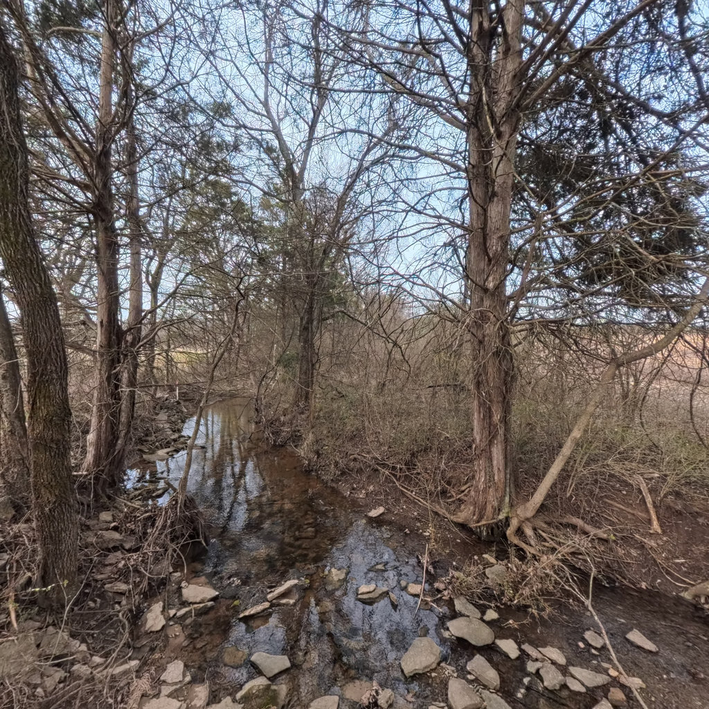
Summary: Front Looking downstream, the channel curves slightly to the right through a narrow, wooded riparian corridor. A pool of standing/slow-moving water is visible with brown-tinted, slightly turbid water reflecting bare tree canopy. Large woody debris including a fallen log spans across the channel. Open agricultural field is visible to the left beyond the thin riparian strip. Right Looking toward the right bank (left bank when facing downstream), a steep wooded slope rises from the channel. Several deciduous trees in bare winter condition are present, along with a large fallen tree spanning horizontally. The ground is covered with leaf litter and some small rocks/rubble visible at the base near the channel. Beyond the riparian trees, an open agricultural or pasture field is faintly visible through the tree trunks. Back Looking upstream, the channel is visible as a shallow, flowing reach with brown-tinted water over a substrate that appears to be a mix of exposed rock and gravel. Significant root exposure is visible on the left bank (right bank facing downstream) where trees are perched above eroded banks. The channel appears slightly wider upstream. Open fields are visible on both sides beyond the narrow riparian corridor. Some flat rock fragments in the channel could be natural limestone bedrock or potentially concrete rubble—warrants closer inspection. Left Looking toward the left bank (right bank when facing downstream), an open agricultural pasture/field extends to the horizon. A red barn or agricultural building is visible in the distance. The riparian corridor is extremely narrow at this point, consisting of only a single row of bare deciduous trees and sparse shrubs. The transition from pasture to stream bank is abrupt with minimal buffer. Some green herbaceous growth is visible at ground level suggesting early spring emergence.
Front
W 273°

Right
N 3°

Back
E 93°

Left
S 183°

Up

Down
Summary: Front Looking downstream, a narrow stream channel winds through a deciduous riparian corridor with bare winter trees. The channel is shallow with exposed flat rock/stone substrate and very low water. In the distance, what appears to be a structure or building is partially visible through the trees. Right Looking toward the right bank (left bank when facing downstream), dense bare deciduous shrubs and small trees are visible with exposed root systems at the bank edge. Beyond the riparian zone, an open agricultural field/pasture is visible in the background with what appears to be bare or dormant brown grass. Significant bank undercutting is evident with exposed roots. Back Looking upstream, the stream channel extends with shallow turbid water over a rocky/gravel bed. The left bank shows exposed root wads from a large tree with significant undercutting. Open agricultural/pastoral land is visible on the left (right bank facing downstream) through sparse riparian trees. A fencing post or marker stake may be visible on the right side. Left Looking toward the left bank (right bank facing downstream), an open agricultural pasture field extends beyond a very thin riparian buffer. A red barn/agricultural structure is visible in the distance. A marker stake with red and white markings is visible at the bank edge. Flat rocks/stones are piled along the bank top, which could be placed stone or natural limestone outcrop — requires closer inspection. The riparian buffer is extremely narrow, perhaps only 10-20 feet of scattered trees.

Front
WSW 256°

Right
NNW 346°

Back
ENE 76°

Left
SSE 166°

Up

Down
Summary: Front Looking downstream, a narrow stream channel flows between wooded banks with bare deciduous trees. The left bank features a prominent exposed rock/stone ledge face approximately 3-4 feet high. A red and white survey rod or marker stake is visible at the bank edge. Agricultural fields and a red barn are visible in the background through the bare trees on the left side. Right The right bank (facing downstream) shows a densely vegetated area with bare deciduous trees and thick understory of dormant shrubs, vines, and herbaceous vegetation. The area appears to be a wooded riparian buffer zone with several Eastern Red Cedar trees (evergreen) mixed among deciduous hardwoods. Ground cover is dense with leaf litter, dormant vines (possibly Japanese honeysuckle), and low vegetation. Some green ground cover visible even in winter. Back Looking upstream, the narrow stream channel winds through a wooded corridor. Both banks are lined with trees including Eastern Red Cedar and bare deciduous hardwoods. The stream bed shows exposed rock substrate and shallow flowing water with visible ripples. Rocky material is visible on both banks, with the right bank (looking upstream, which is left bank facing downstream) showing exposed flat rock ledges. Agricultural fields are visible in the background through gaps in the tree line. Left The left bank (facing downstream) shows an open agricultural field extending to the horizon with brown dormant grass or harvested crop stubble. The riparian buffer between the stream and the field is very narrow, consisting of a thin line of trees with a fence line visible at the edge. The field appears to be actively farmed pasture or row crop land. Hills with forested ridgeline visible in the far background. Some stone visible at the base of the bank edge near the camera position.
Front
W 272°

Right
N 2°

Back
E 92°

Left
S 182°

Up

Down
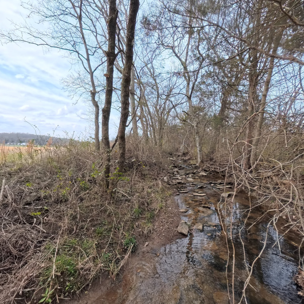
Summary: Front Looking downstream, a narrow shallow stream flows over exposed flat limestone/bedrock substrate with scattered thin rock slabs. The channel is very narrow (approximately 3-5 feet wide) with minimal water depth. Deciduous trees (bare) and cedar trees line both banks, with open agricultural fields visible to the left beyond a thin riparian strip. Dense dormant brush and debris are present along both banks. Right Looking toward the right bank (facing downstream), a cedar tree with exposed roots stands at the bank edge. The bank rises moderately with dense dormant brush, vines, and dead herbaceous vegetation. Beyond the narrow riparian strip, what appears to be agricultural land or open fields with structures (possibly farm buildings) are faintly visible through the bare vegetation. The bank shows some root exposure and bare soil patches. Back Looking upstream, the narrow channel continues with shallow water flowing over exposed bedrock/limestone substrate. A large cedar tree with significant root exposure grows on the left bank, leaning over the channel. Flat limestone bedrock forms the channel bed with thin sheets of rock visible. The right bank shows exposed rock ledges. Dense dormant vegetation and open agricultural fields are visible beyond the narrow riparian corridor on the right side. A person in safety gear (the surveyor's equipment) is partially visible at the right edge. Left Looking toward the left bank (facing downstream), a field surveyor wearing a Petzl safety helmet and high-visibility gear is visible wading in the stream. The left bank is low with bare soil and scattered flat limestone rock fragments. Beyond the narrow band of dormant trees and shrubs, open agricultural fields with a red barn or farm building are clearly visible, indicating a very thin riparian buffer on this side. The bank has moderate bare soil exposure with some dormant herbaceous cover.

Front
W 273°

Right
N 3°

Back
E 93°

Left
S 183°

Up

Down
Summary: Front Looking downstream, a very narrow channel (approximately 3-5 feet wide) winds through a riparian corridor of bare deciduous trees. The streambed is dominated by flat limestone/bedrock substrate with a thin sheet of water flowing over it. Open agricultural fields are visible through the trees on the left side. Some green vegetation (possible evergreen or early-emerging invasives) is visible on the right bank. Right The right bank (left bank when facing downstream) shows a large mature sycamore tree trunk dominating the foreground, with lichen-covered bark. Behind it, the right bank rises moderately with dormant deciduous shrubs and small trees forming a dense understory. Some green vegetation is emerging at lower levels, possibly including invasive honeysuckle or privet. The riparian zone extends into what appears to be woodland or scrubby vegetation. Back Looking upstream, the narrow channel continues with the same bedrock/limestone substrate and very shallow flow. The channel is bordered by bare deciduous trees and shrubs. A few evergreen trees (likely eastern red cedar) are visible in the riparian zone. Open agricultural fields can be seen through the trees on the right side. The stream appears to have a slight sinuosity as it bends through this corridor. Left The left bank (right bank when facing downstream) shows open agricultural fields beyond a narrow riparian strip. A red barn/outbuilding is visible in the distance across the field. The riparian buffer on this side consists of bare deciduous trees (including sycamore) and dense dormant shrubs, with some green leafy vegetation at ground level that may include invasive species such as bush honeysuckle or multiflora rose retaining some green foliage. The buffer appears relatively narrow, transitioning quickly to open pasture/cropland.

Front
W 266°

Right
N 356°

Back
E 86°

Left
S 176°

Up

Down
Summary: Front Looking downstream, a narrow stream channel is visible winding through a wooded riparian corridor. The left bank opens to a broad agricultural field (pasture/hay) with a red barn visible in the far distance. The channel bed is dominated by flat, layered limestone bedrock and cobble-sized rock fragments. Bare deciduous trees line both banks. Right The right bank rises moderately into a wooded hillside with bare deciduous trees and some eastern red cedar. The understory is sparse with dormant herbaceous vegetation and leaf litter. Through the trees, what appears to be exposed reddish-brown earth or a cleared area is visible on higher ground, possibly a field edge or disturbed area. A small amount of water is visible at the lower left edge of the frame. Back Looking upstream, the narrow stream channel continues through a corridor of dense bare deciduous trees and shrubs. The channel bed is exposed limestone bedrock with flat layered surfaces and rubble. A shallow flow of slightly turbid water moves across the bedrock surface. Vine tangles and dormant shrub thickets are visible on both sides of the channel, and the stream appears to bend slightly. Left The left bank transitions from a narrow riparian tree line into a broad, flat agricultural field (pasture or hay field) that extends to the horizon. Dormant grass covers the field, and a red barn/agricultural building is visible in the middle distance. The riparian buffer on this side is very narrow - only a single row of mature trees separates the stream from the open field. Some exposed soil and rock is visible at the bank toe.

Front
WNW 292°

Right
NNE 22°

Back
ESE 112°

Left
SSW 202°

Up

Down
Summary: Front Looking downstream, a narrow channel with very low flow is visible winding through a heavily wooded corridor. The bed is dominated by flat, angular limestone/shale slabs with shallow pools of still to barely flowing water. Deciduous trees are mostly bare with early spring bud break visible on a few small saplings. Right The right bank (left bank facing downstream) shows a steep, eroded bank approximately 3-5 feet high with exposed soil and root systems. Dense vine and shrub tangles cover the bank top. Through the bare trees, an open agricultural field or pasture is visible in the background, indicating the riparian buffer is relatively narrow on this side. Back Looking upstream, the narrow channel continues with shallow water flowing over exposed limestone bedrock slabs. The channel is flanked by bare deciduous trees with an open field/pasture visible through the vegetation on the right side. A person wearing high-visibility safety gear is visible, confirming wading/backpack pole capture method. The channel substrate is entirely natural bedrock/limestone. Left The left bank (right bank facing downstream) shows a moderately steep bank with dense shrub and vine tangles. Through the bare vegetation, open agricultural/pasture land is clearly visible. The riparian buffer appears narrow, approximately 25-50 feet wide, with a mix of small trees and dense understory. Rock fragments visible at base of bank are consistent with natural limestone bedrock.

Front
WSW 252°

Right
NNW 342°

Back
ENE 72°

Left
SSE 162°

Up

Down
Summary: Front Looking downstream (direction of travel), the view shows a narrow stream channel flanked by bare deciduous trees and dense shrubby understory. Beyond the immediate riparian corridor on the left, a large open agricultural field (dormant pasture/hay field) is visible extending to distant treeline and structures. The right side has a thicker riparian strip with exposed rocky bank material visible at the lower edge. Right Looking toward the right bank (when facing downstream), a dense thicket of bare deciduous shrubs and small trees occupies the bank zone. Rocky/stony material is visible along the lower bank at left edge where it meets the channel. The riparian zone extends with moderate depth of woody vegetation before giving way to what appears to be more open land beyond. Some flat stone slabs are visible at the bank-channel interface. Back Looking upstream, the narrow channel is visible with a rocky/cobble bed showing shallow flowing water. The stream appears to be a small first or second order channel with exposed flat stone substrate. Both banks are vegetated with bare deciduous trees and shrubs. The channel is quite narrow, perhaps 3-5 feet wide, with the rocky bed dominating the view. A sycamore tree is visible on the right side with its characteristic white bark. Left Looking toward the left bank (when facing downstream), the view opens to a wide, flat agricultural field — dormant pasture or hayfield — extending to distant hills. A red barn/agricultural building is visible in the distance to the right. The riparian buffer on this side is extremely narrow, consisting of only a few scattered trees and sparse shrub cover along the bank edge before transitioning immediately to open pasture. The bank drops steeply from the grassy field to the channel.

Front
NW 305°

Right
NE 35°

Back
SE 125°

Left
SW 215°

Up

Down
Summary: Front Looking downstream, a very narrow channel with minimal water flows over exposed flat limestone/shale substrate. A red-roofed structure (likely a barn or outbuilding) is visible through bare deciduous trees on the left bank. The channel is bordered by dense dormant shrubs and small trees, with abundant flat rock pieces scattered along both banks and in the channel bed. Right The right bank (when facing downstream) shows a steep, heavily vegetated bank rising above the channel. Dense dormant shrubs, vines, and small deciduous trees cover the bank. A large fallen tree is visible spanning across the upper bank area. Flat limestone/shale rock fragments are visible at the base of the bank near the channel edge. Some early green herbaceous growth is emerging on the ground surface. Back Looking upstream, the narrow channel continues through a wooded corridor. A large eastern red cedar tree is prominent in the center view. Water is visible flowing over flat rock substrate with exposed bedrock ledges. The right bank has flat rock ledges at water level, and a field surveyor in dark clothing is partially visible on the right side. Beyond the riparian corridor, open agricultural/pastoral land and possibly structures are visible in the distance through bare trees. Left Looking at the left bank (when facing downstream), a field surveyor wearing a Petzl helmet and dark clothing is visible in the foreground. The left bank rises moderately with exposed soil, rock fragments, and dense dormant shrubs and small trees. Beyond the narrow riparian strip, open agricultural/pastoral fields with brown grass are visible in the distance. The bank shows some exposed soil and rock. A small pool or standing water is visible at the channel edge near the surveyor's feet.